Still facing pushback from the federal government over permitting, Seaside Park officials have grudgingly decided to change the scope of an anti-flooding project that has been pending for years while caught up in bureaucratic red tape.
The bayside flood mitigation project, which received grant funding in the years following Superstorm Sandy and has been held up by dueling state and federal permitting agencies ever since, involves the creation of a “living shoreline” made of an oyster reef to attenuate wave action and foster species growth, additional sand added to the bayfront in order to physically move the water line back, and provide a better buffer between the bay and the surrounding neighborhood.
The scope of the multi-phase project, however, is being revised. Seaside Park officials say the state Department of Environmental Protection has granted its permits for the project, and it has received letters of support from a number of environmental advocacy organizations. But the federal U.S. Army Corps of Engineers has refused to sign off on the plan because of concerns over submerged aquatic vegetation – colloquially known as eel grass – near the bayfront. On numerous occasions, experts in the field of marine biology have testified that there is little to no such vegetation (known by its acronym “SAV”) in the area, but their case has not motivated the federal agency to act.
Instead, in a meeting held last year, the borough was asked to scale back the project. The borough council recently passed an ordinance directing the RVE engineering firm to re-design the scope of the project to reflect the specifications of the Army Corps’ request, Mayor John Peterson said.
“It changes the pitch and the height somewhat,” the mayor explained, referring to a protective dune that would help prevent bay water from overflowing the bulkhead during storms. “Mostly, the proposal seeks to take away a whole row of HESCO baskets that would be filled with oyster spat. They’re proposing for the Army Corps to take one whole row away.”
The plan called for 30 additional feet of sand to be delivered to effectuate a new mean high-water line, followed by a 1:10 slope down to the existing bay floor. Public access at each perpendicular street end would be afforded by pedestrian walkways over the dunes onto the beach. Current plans call for a new bulkhead to be built farther inland, effectively in the shoulder of what is now Bayview Avenue, and be two feet higher than the existing bulkhead, which would be covered in sand as part of the replenishment project.
Offshore in shallow water that dominates this part of Barnegat Bay, a staggered orientation series of eight Hesco-style steel baskets filled with 4 to 6-inch stone and encapsulated with shell had been proposed to be installed along the segment as two back-to-back rows of baskets 10-by-30 feet long, oriented to generally face the northwest wave approach direction and a second single row of HESCO baskets in parallel formation to the front rows, but set back landward by 50 feet.
“I just hope the re-design does not change the effectiveness of the wave dissipation,” said Councilman William Kraft, whose reaction mirrored that of his colleagues. “They want us to save some of the SAV, but at what cost to us?”
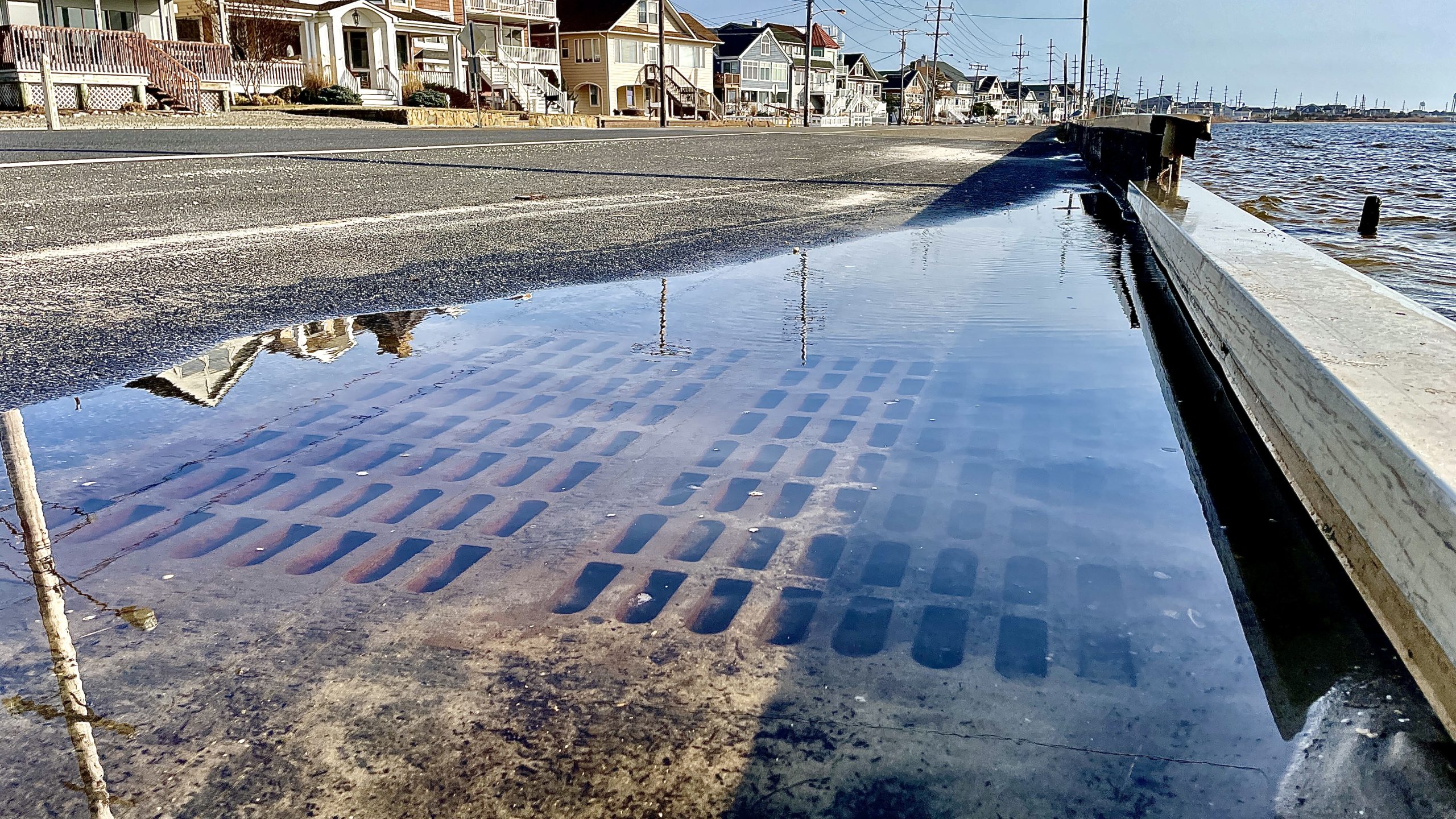
Flooding during a typical high tide on a fair-weather day in Seaside Park along Bayview Avenue, Feb. 2024. (Photo: Shorebeat)
Then, Peterson said, there is the issue that SAV is near non-existent at the site in the first place, as demonstrated by the borough’s consultant on the project. Dr. Stewart Farrell of Stockton University.
“Dr. Farrell walked the water with them to literally point out that there is no eel grass in this area, and they saw it and agreed with that,” Peterson said.
There are additional modifications the federal government requested, said Kraft.
“They’re also cutting back on the toe of the sand at the edge of the bay,” he said. “They’re screwing up the design.”
Unfortunately for officials and bayside residents, there seemed to be no sign the Army Corps would waiver on its position. Some residents at a recent meeting of the borough council suggested holding a large public meeting to discuss flooding, the overall project, and organize a campaign to grab the attention of either the Army Corps or the borough’s congressional representatives to become involved.
“I wish they could come to my house,” said resident Shirley Kreszl. “I have waves hitting my house.”

Flooding in Seaside Park, Nov. 26, 2018. (Photo: Daniel Nee)
One of the problems, she said, is that residents do not know who to contact in order to advocate for their position.
“It’s hard for a lot of people to figure out who we’re even writing to,” she said, suggesting the borough provide points of contact and send out a letter to residents. “We could reach a lot of people that way, and maybe a little pressure would help.”
The council authorized RVE to expend no more than $18,000 to revise the redesign of the first phase of the project. The plan calls for the work to be completed in phases, and ultimately run from the intersection of H Street and North Bayview Avenue to the intersection of Island Avenue and North Bayview Avenue.


Seaside Heights & Seaside Park
Seaside Heights School Board Seeking More Participation, Will Change Meeting Times

Police, Fire & Courts
Seaside Park Man, 68, Charged in Fatal Crash With Pedestrian

Ortley Beach & North Beaches
Lottery Ticket Worth $10K Sold at Ortley Beach Acme


Ortley Beach & North Beaches
Abandoned Private Island ‘Mansion’ in Barnegat Bay Poised for Demolition

