Seaside Park officials are continuing their longtime effort to tackle back bay flooding, and there may be a light at the end of the regulatory tunnel.
Residents who attend meetings of the borough council often ask about both short term and long term solutions to bayside flooding. A long-term project consists of a living shoreline, breakwater and the widening of the bay beach berm to its previous size. The project, despite the funding already being in place, has been held up by the U.S. Army Corps of Engineers, which had long been requesting an “SAV mitigation plan” for the bayfront. “SAV” stands for “submerged aquatic vegetation” – what most residents normally call sea grass or seaweed. The state Department of Environmental Protection, notably, has approved of the borough’s plan.
In the shorter term, officials have installed check valves on outfall pipes in different areas of the borough, and though they have been successful in some cases, larger storms can be too much for the devices to handle.
Long-Term Plans
On Thursday, the council re-appropriated funds from an unused bond to be used toward the SAV mitigation study upon news that the federal government has clarified aspects of what it expects from the municipal government. The council adopted an ordinance that sets aside $68,500 of unused funds that will go toward the development of a study into sea grass and how a living reef and shoreline stabilization project would affect it. Most local officials have long held that the borough’s immediate bayfront generally has little submerged aquatic vegetation in the first place, and an artificial reef project may actually foster the growth of additional plant species while simultaneously absorbing currents and preventing flooding.
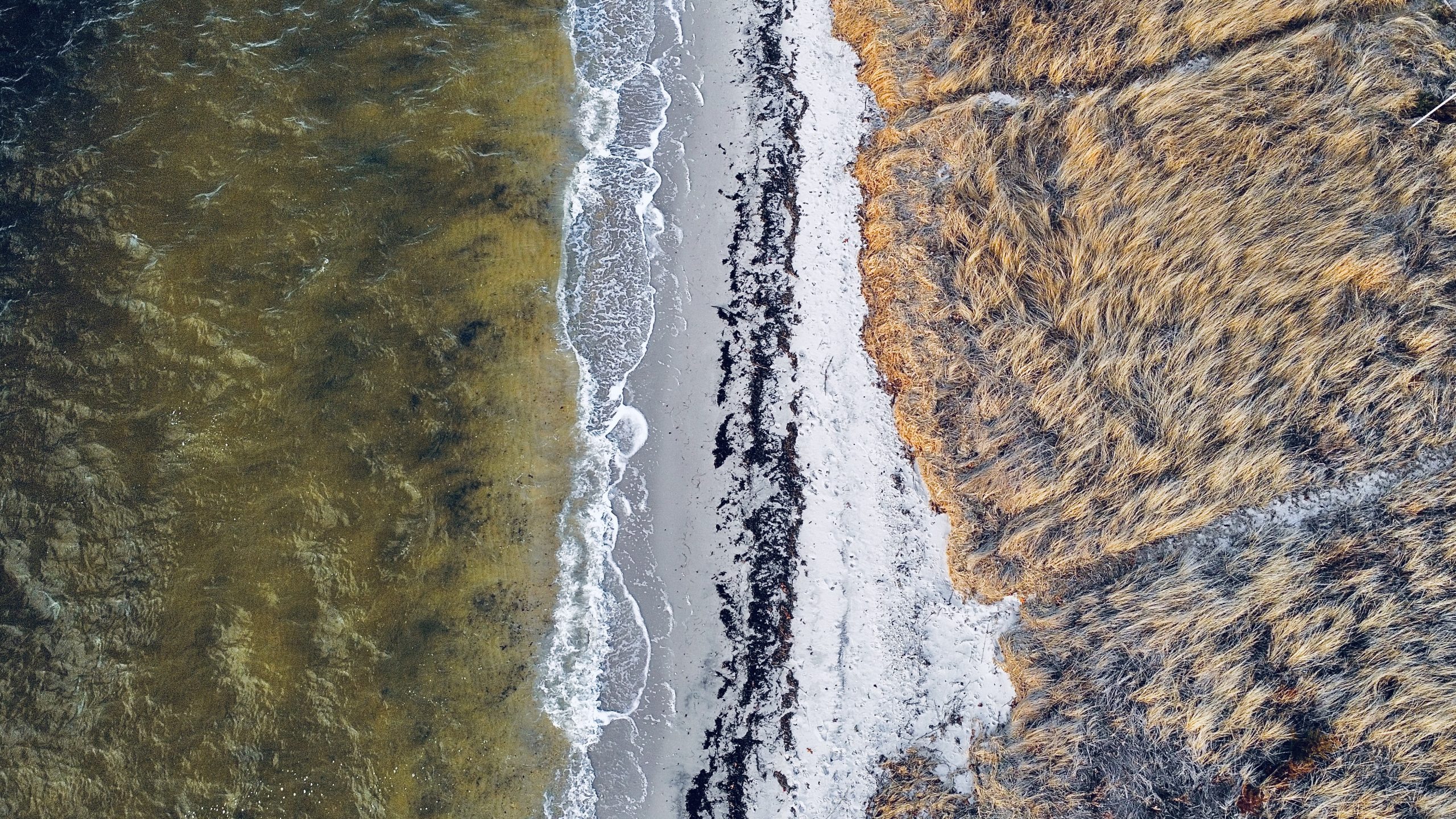
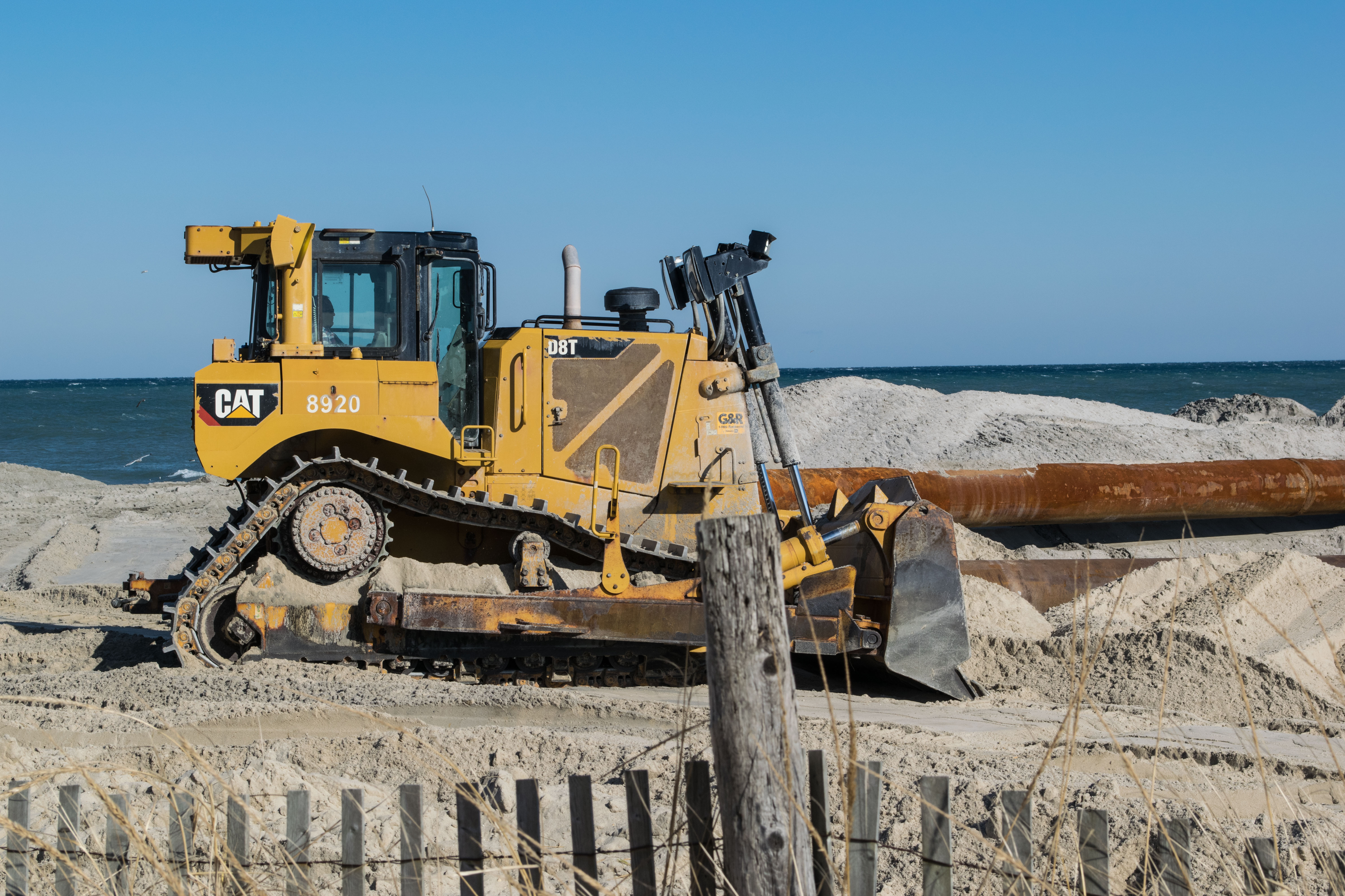
The Seaside Park bayfront along Bayview Avenue, Feb. 2023. (Photo: Daniel Nee)
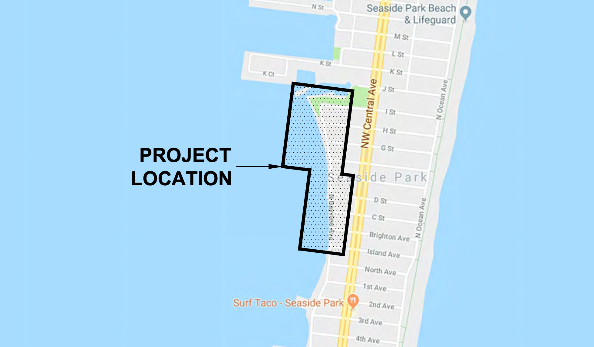
The location of a natural breakwater project designed by Seaside Park for the northern bayfront. (Credit: Planning Document/RVE)
“They had not given us a realistic inkling of what kind of plan they were talking about, at least the extent of it, but recently they’ve handed us a clearer picture of something that seemed affordable,” said Mayor John Peterson.
The borough will use a portion of the funding, about $21,000, to partner with the American Littoral Society and the Stockton University Coastal Institute to create an SAV mitigation plan that will satisfy the Army Corps’ concerns. Previously, the Army Corps had not expressed the breadth of what such a plan would include in terms of the physical area covered, but recent correspondence has set location guidelines that reduces the mitigation area from acres upon acres of bayfront to specific areas.
The borough’s plan centers on building out a number of platforms on the bayside to mitigate flooding, protect the shoreline, form a breakwater and foster the growth of native species on a “living reef” which would naturally absorb the impact of wave action. In a move few initially thought would be feasible, the borough – with assistance from a team of engineers and academics from Stockton – were able to convince the state that the shoreline could be safely restored to its former size, as published in a 1977 survey. Expanding the width of the bayfront would not only raise the grade of the shoreline, but leave enough room for a second bulkhead and an oyster reef which would serve the dual purpose of restoring aquatic life to the bayfront and mitigating wave action. The entire effort would be combined with a project to raise the elevation of Bayview Avenue and install check valves on outfall pipes to prevent water from backwashing onto the roadway.
Short Term Solutions?
In the shorter term, the borough will continue to maintain its check valves, essentially one-way flappers that allow water to exit from storm drains into the bay but close to prevent bay water from backwashing through the drain and into the street. The borough experimented with different types of valves, ultimately deciding on the Tideflex brand. While the valves have not been perfect, they have tamped down flooding in some areas, officials have said.
“We’re going to continue regular maintenance of the Tideflex valves, but we know the challenges when the water level rises above a certain height,” said Peterson.
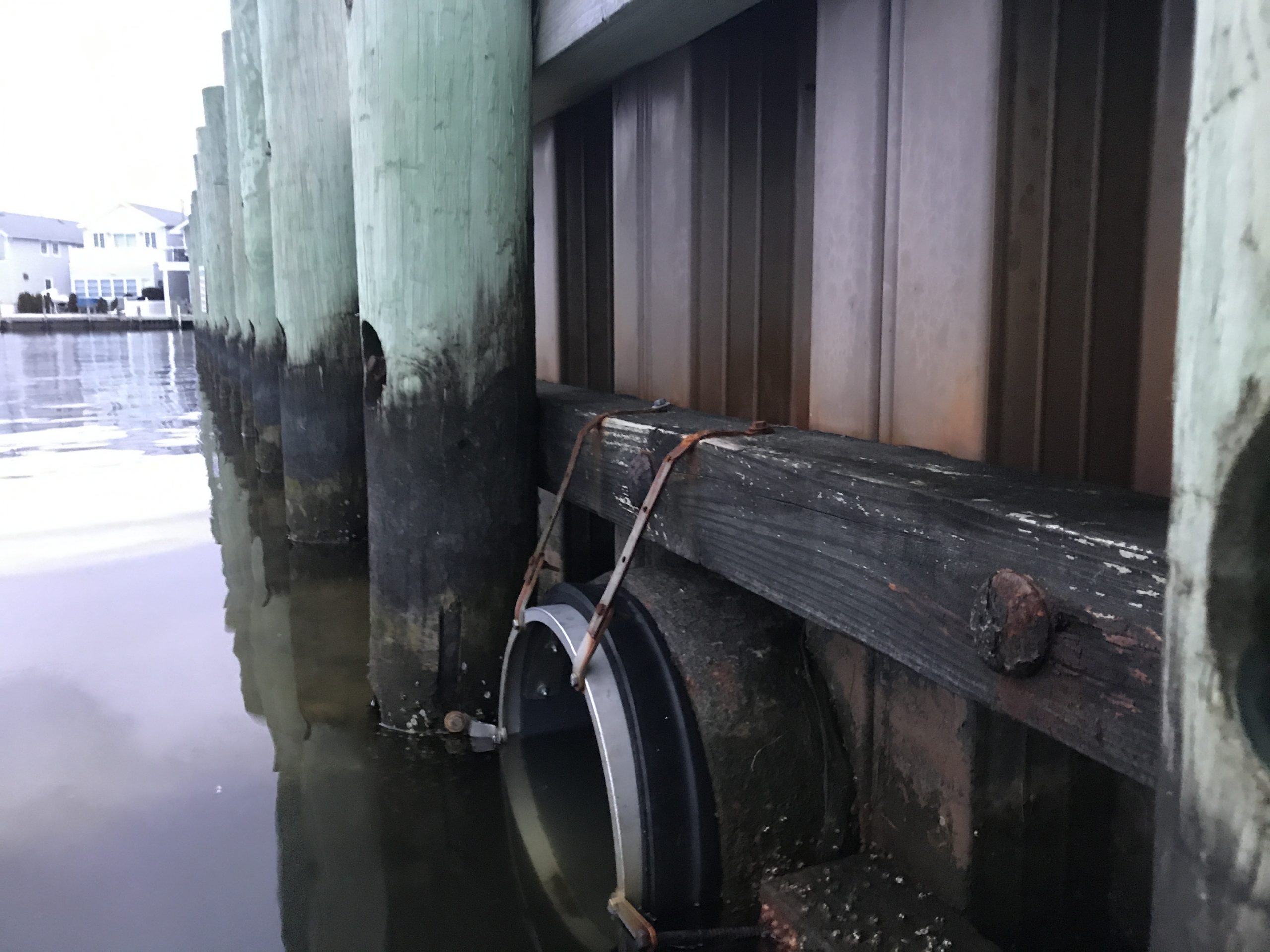
Flapper valves installed at M Street in Seaside Park. (Photo: Daniel Nee)
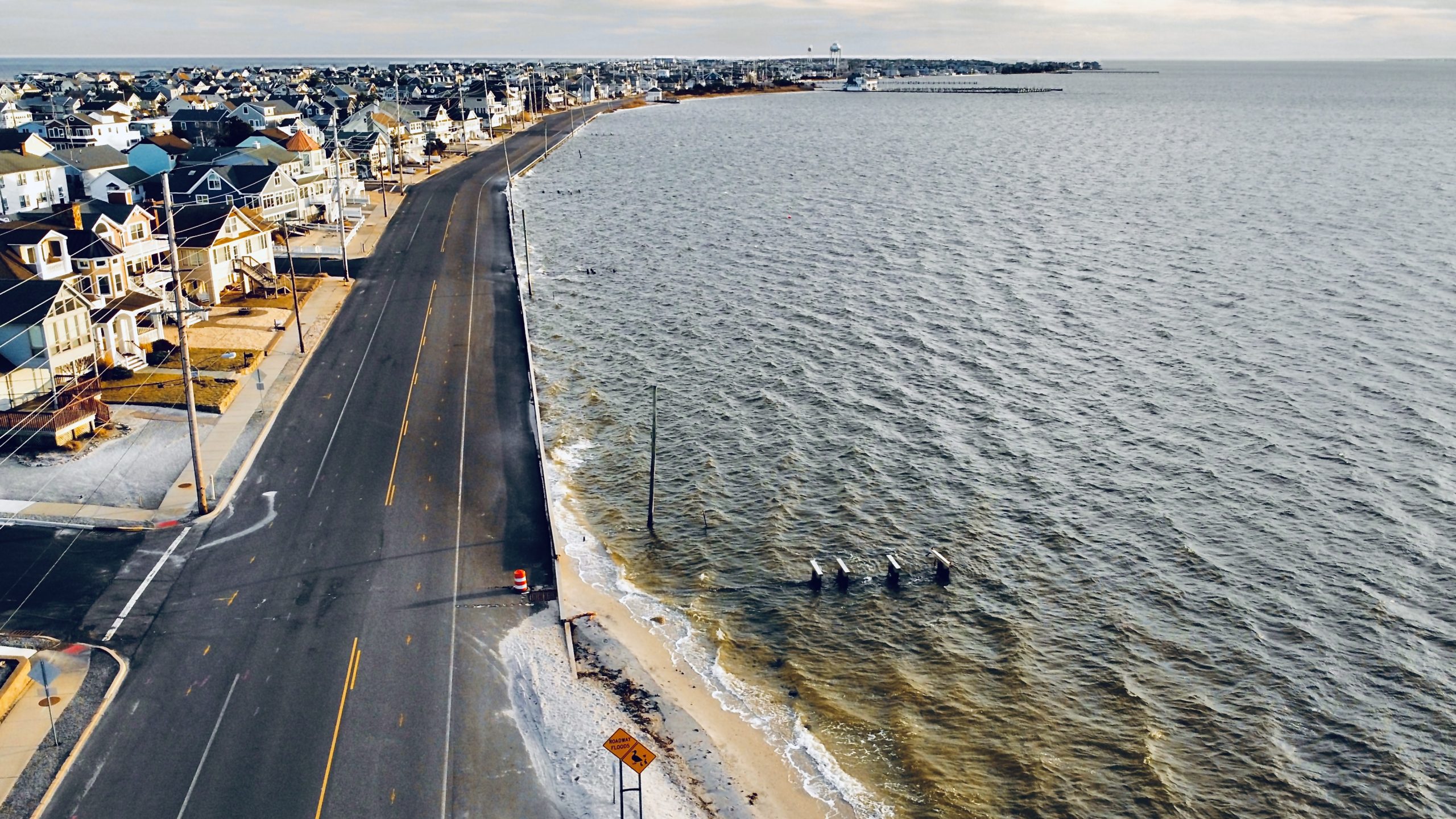
The Seaside Park bayfront along Bayview Avenue, Feb. 2023. (Photo: Daniel Nee)
The valves require frequent maintenance largely because of the water levels that have been experienced in Seaside Park in recent years. Once the water level reaches a certain height against a bulkhead, the valves become less effective.
“It doesn’t take much for these things to stop working,” said Councilman Frank “Fritz” McHugh at a meeting last month. “A couple pebbles get in there, and these things don’t work anymore.”
Councilman Marty Wilk also expressed the need for continued maintenance.
“We’ve spoken to everyone about it. It’s almost level-grade,” he said, regarding the valves compared to the depth of the water. “The water basically came over the high curb and sought its own level.”
Indeed, he said, the water level became so high in a recent coastal storm that a significant number of fish were found in the middle of the street once the flood receded.
Borough Administrator Karen Kroon said there have been examples of the valves working well, however, including on M Street.
The valves, however, are part of a more holistic plan, officials say, and will work better when paired with the larger project that will prevent the water level from becoming so high close to shore.
“We do intend to install more – I can’t say immediately – but we had a grant from FEMA that is currently being appealed and that is part of that,” said Peterson.
Peterson also said Ocean County officials would be addressing an issue near I Street and the surrounding area where rocks from a revetment occasionally find their way into the road during periods of high tides.
“We’ve written them quite extensively asking them to try something else in the short term, and they said they will,” he said.
A future project will change the look of the bay beach somewhat, though it will be larger and – officials hope – offer easier access.
Current plans call for a new bulkhead to be built farther inland, effectively in the shoulder of what is now Bayview Avenue, and be two feet higher than the existing bulkhead, which would be covered in sand as part of the replenishment project. The new bulkhead would feature walkovers to allow public access to the bayfront sand. The area between the new and old bulkheads would be covered in vegetation such as dune grass and native plants.


Seaside Heights & Seaside Park
Annual Turkey Dinner to Support Tri-Boro First Aid Squad: Tickets Available


Seaside Heights & Seaside Park
Seaside Heights Italian Festival, Columbus Day Parade to Return Oct. 11-13

Seaside Heights & Seaside Park
Dramatic Water Rescues Occur in Seaside Park As Rip Current Warning Remains in Effect


Ortley Beach & North Beaches
Abandoned Private Island ‘Mansion’ in Barnegat Bay Poised for Demolition
