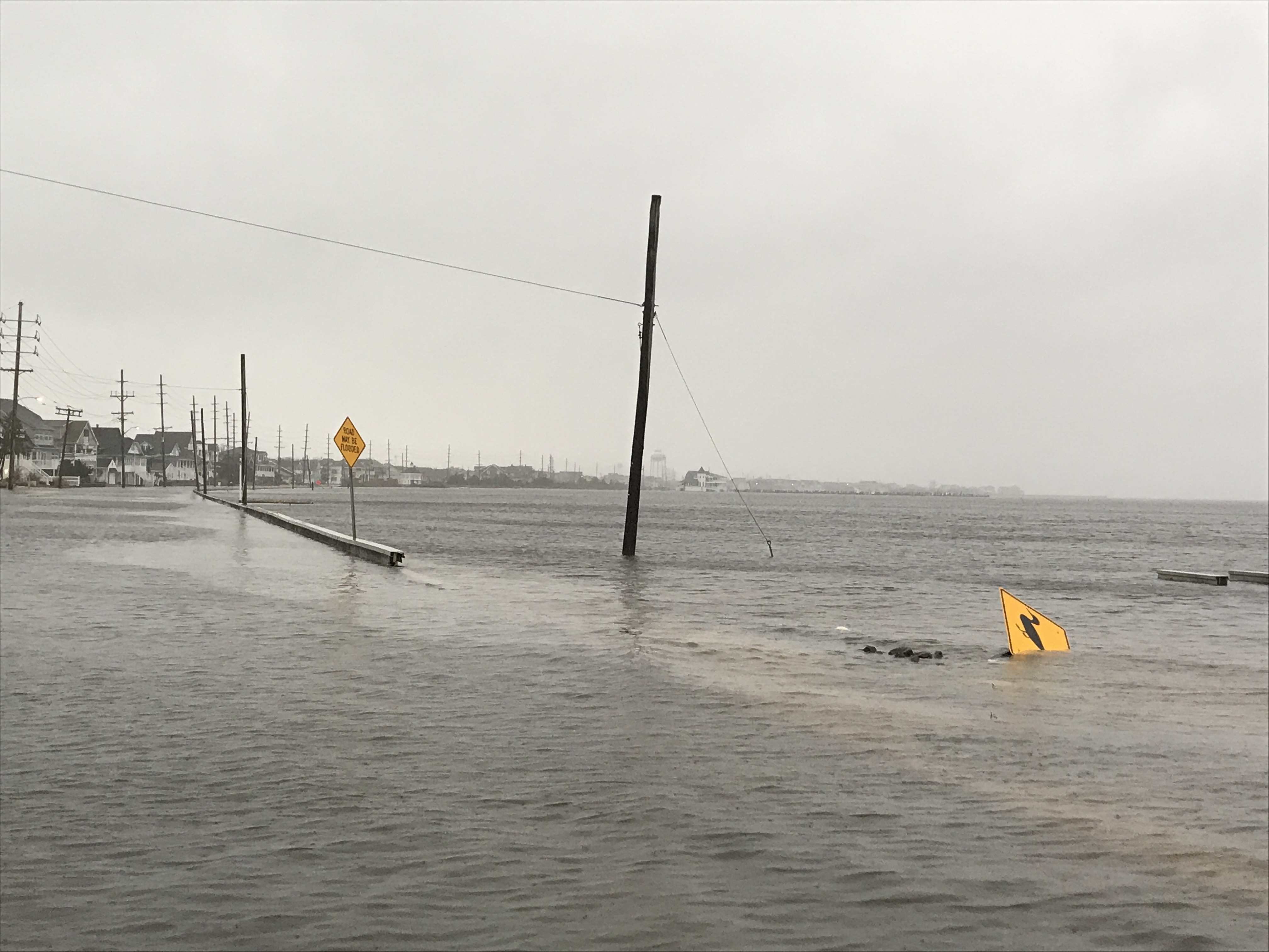
A coastal storm expected to move into the region Friday night will bring strong northeast winds to the Jersey Shore that forecasters say is likely to trap water in the bay, leading to tidal flooding that could cause property damage. Meanwhile, a high rip current advisory, high wind warning and coastal flood warning were all in effect as residents and businesses prepared for the storm.
A spectacular sunset (embedded in our video above this story) brought sightseers out to street ends at Barnegat Bay Thursday night, however outdoor adventures will likely come to an end Friday evening. According to the National Weather Service, a rip current advisory is in effect until Saturday at 8 p.m., a high wind advisory is in effect for the same time period as well as a coastal flood warning.
The NWS forecast said winds will increase to 10-20 m.p.h. from the north during the day Friday before rain – sometimes heavy, and accompanied with thunderstorms – moves in after 2 a.m. during the overnight hours. The wind speed will steadily increase to 30-40 m.p.h. with 60 m.p.h. gusts from the northeast, leading to a “backup” of water in the bay that may lead to damaging flooding.
“With the long duration of onshore winds expected, the back bays may struggle to drain during low tides,” the NWS statement said. “This could result in minor to moderate coastal flooding lingering after high tide. Additionally, minor flooding is possible again with the Sunday afternoon high tide.”
In Barnegat Bay, high tide occurs at 5:31 a.m. and 6:02 p.m. Friday and 6:39 a.m. and 7:08 p.m. Saturday.
The storm could bring between a quarter and half of an inch Friday night, another 1-2 inches of rain during the day Saturday and up to another inch Saturday night into Sunday. The system will gradually move out Sunday, though another quarter to half-inch of rain could fall.
“For the Coastal Flood Warning, one to two feet of inundation above ground level is expected in low-lying areas near shorelines and tidal waterways,” the NWS said.
Rip currents were expected to be life-threatening across the entire region, and every local community has prohibited swimming this weekend.
The NWS’s Surf Zone forecast predicted 4-16 foot waves Friday and 10-12 foot waves in the surf zone on Saturday, both days carrying a “high” risk of deadly rip currents.

Advertisement

Seaside Heights & Seaside Park
Seaside Heights School Board Seeking More Participation, Will Change Meeting Times

Police, Fire & Courts
Seaside Park Man, 68, Charged in Fatal Crash With Pedestrian

Ortley Beach & North Beaches
Lottery Ticket Worth $10K Sold at Ortley Beach Acme

Ortley Beach & North Beaches
Abandoned Private Island ‘Mansion’ in Barnegat Bay Poised for Demolition


