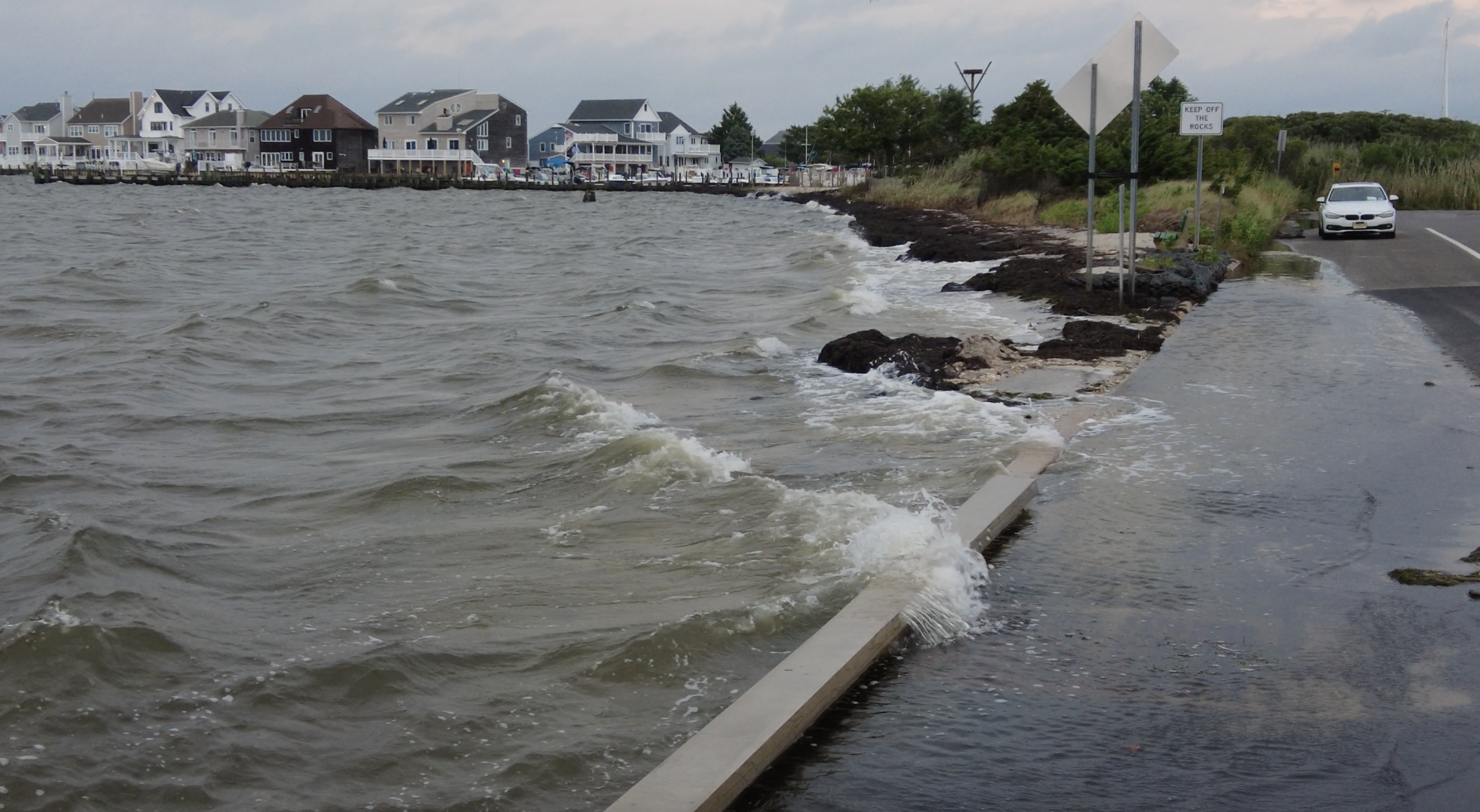
Seaside Park’s major initiative to curb bayside flooding and re-engineer a large portion of the town’s bayfront remains in limbo, with the U.S. Army Corps of Engineers offering no recent responses from officials on when they will sign off on – or deny – the plan to go forward.
The borough’s auspicious plan to construct a large living shoreline with a breakwater along much of the northern portions of Bayview Avenue has received support from a slew of organizations and government agencies, including the American Littoral Society, Ocean County and the state Department of Environmental Protection. But since projects in waterways such as Barnegat Bay require additional permitting from the U.S. Army Corps of Engineers, work cannot begin until the federal agency signs off on the program.
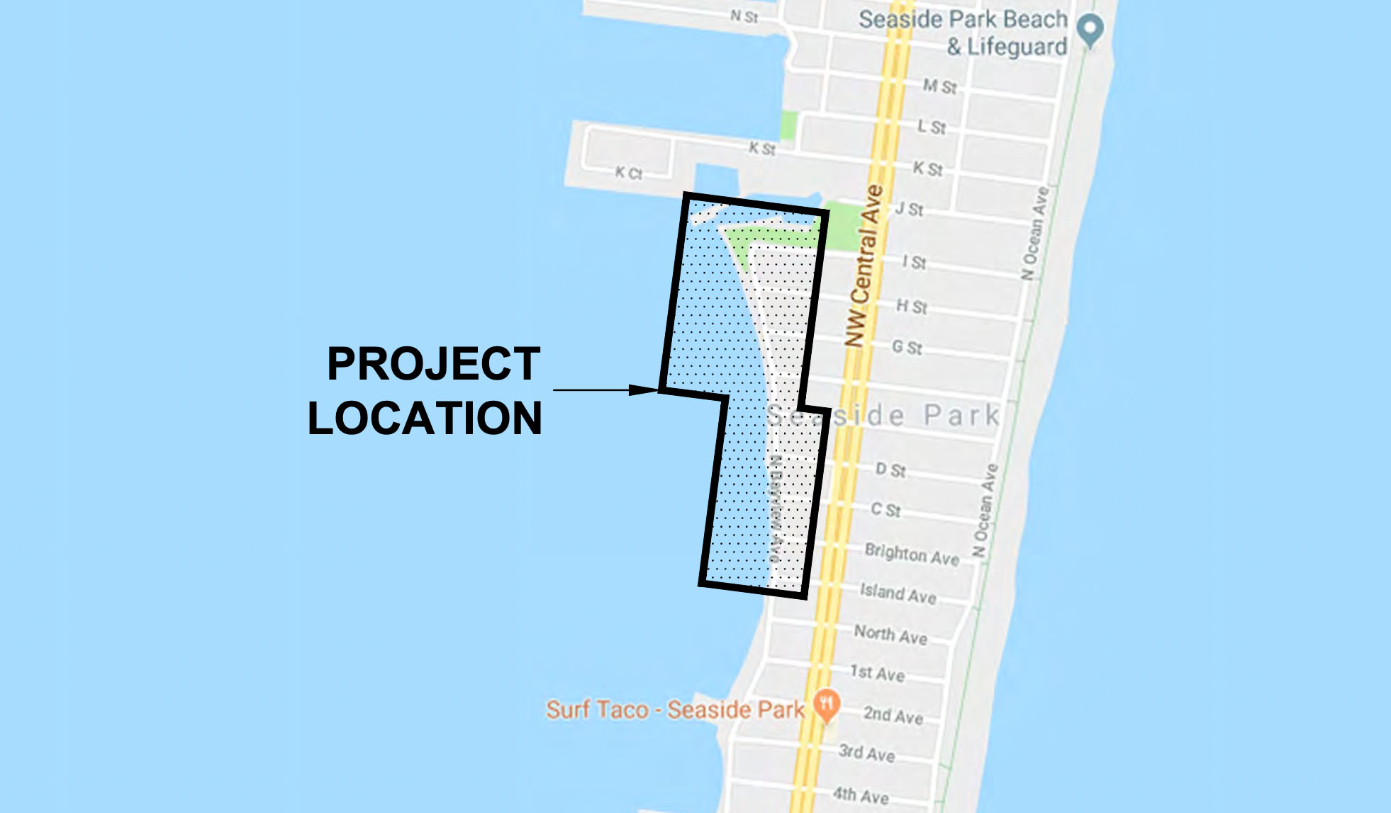
The location of a natural breakwater project designed by Seaside Park for the northern bayfront. (Credit: Planning Document/RVE)
The sticking point – which has now been mired in discussions and periods of non-discussions for multiple years – centers on “SAV,” or submerged aquatic vegetation. The Army Corps has not granted a permit for SAV to be disturbed in the bay, despite the fact that officials have confirmed zero to minimal SAV along the shoreline and there is a strong argument to be made that the borough’s plan would increase the habitat for aquatic plants.
At a borough council meeting Thursday night, the governing body authorized its engineer to submit an application to extend a permit already granted by the Ocean County Soil Conservation District to allow the project to move forward, a requirement since federal inaction has prevented the work from beginning during the time allotted in a standard county permit. The lack of movement on the part of the Army Corps has frustrated officials – and residents – all of whom say the flooding is getting worse as the minimal bulkheading and sandbags present in the most vulnerable areas deteriorate.
“We walked the entire stretch together, live and in person,” said Mayor John Peterson, referring to a group of experts that included a professor at Stockton University, state DEP officials, county representatives and Army Corps employees.
Still, after months, there has been no word from the federal agency on the permit status.
Project Details
Formally known as the “Bayfront Wave Energy Dissipation Project,” the effort will include unique features that officials say will absorb wave energy, mitigate flooding, buffer the shoreline and provide habitat for native species. The plan calls for the work to be completed in phases, and run from the intersection of H Street and North Bayview Avenue to the intersection of Island Avenue and North Bayview Avenue.
The project includes the proposed installation of a living shoreline, which will include a vegetated beach dune system along with an oyster reef breakwater extending from H Street to Island Avenue. Proposed walkovers are to be constructed to maintain public access to the bayfront, according to the proposal published by RVE, the engineering firm retained by the borough to design the project.
The proposed living shoreline will “help to enhance vegetation/habitat, dissipate wave action and stabilize the shoreline along the Barnegat Bay.” Additionally, six existing stormwater outfalls will be replaced and extended, and inline tide valves are to be installed at each stormwater outfall that will stop bay water from backwashing into storm sewers and, ultimately, onto local streets.
The first phase will consist of a 6-foot elevated dune crest that will be 4 feet above the Bayview Avenue Street elevation and 50 feet in toe-to-toe width starting at Bayview Avenue’s western curb line. This reflects the historical width of the beach along the bayfront in surveys conducted in the 1970s and 1980s.
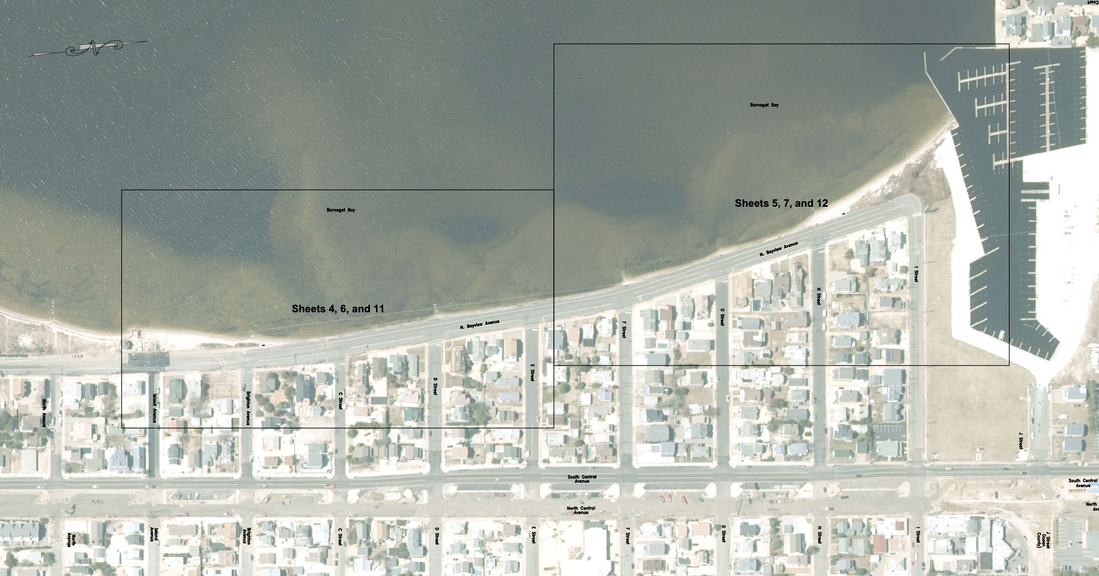
The location of a natural breakwater project designed by Seaside Park for the northern bayfront. (Credit: Planning Document/RVE)
“This dune will blend in with the remnant dunes at both ends of the segment,” the report said. “A sand beach above mean high water will extend into the bay for 30 additional feet to a new mean high-water line followed by a 1:10 slope down to the existing bay floor. Public access at each perpendicular street end will be afforded by pedestrian walkways over the dunes onto the beach.
Traditional dune vegetation will be planted and protected from trespass with appropriate fencing, the report said. Offshore in shallow water that dominates this part of Barnegat Bay, a staggered orientation series of eight Hesco-style steel baskets filled with 4 to 6-inch stone and encapsulated with shell is proposed to be installed along the segment as two back-to-back rows of baskets 10-by-30 feet long, oriented to generally face the northwest wave approach direction and a second single row of HESCO baskets in parallel formation to the front rows, but set back landward by 50 feet.
There will be 100-foot gaps between the sets of baskets to allow some wave passage and fish passage and allow horseshoe crabs and diamondback terrapins, along with recreational small vessels and paddleboards used by local residents and visitors, access to the sand beach.
“This hybrid living ‘breakwater’ will be submerged at high tide and be exposed at low tide,” the report said. “Shells will be set on both faces, the ends and the top surfaces of the reef units and eventually weld the entire array into a potential habitat for organisms in each of the basket units.”
Installation would be from a barge using a small crane to fill and place each basket unit into the formation fronting the bayshore.
Seaside Park officials have said they have gone to great lengths to prove the project would not disturb existing aquatic vegetation but, rather, provide more habitat for it. The borough offered to partner with out-of-state universities to conduct studies that would look into the matter up and down the east coast, but never received a reply to the offer, Peterson has said.
The state and county permits will keep the project alive – on paper – until federal approval is granted, at which point funding will be solidified and work can begin. There is no known timeline for the borough to receive a response.


Seaside Heights & Seaside Park
Seaside Heights School Board Seeking More Participation, Will Change Meeting Times

Police, Fire & Courts
Seaside Park Man, 68, Charged in Fatal Crash With Pedestrian

Ortley Beach & North Beaches
Lottery Ticket Worth $10K Sold at Ortley Beach Acme


Ortley Beach & North Beaches
Abandoned Private Island ‘Mansion’ in Barnegat Bay Poised for Demolition

