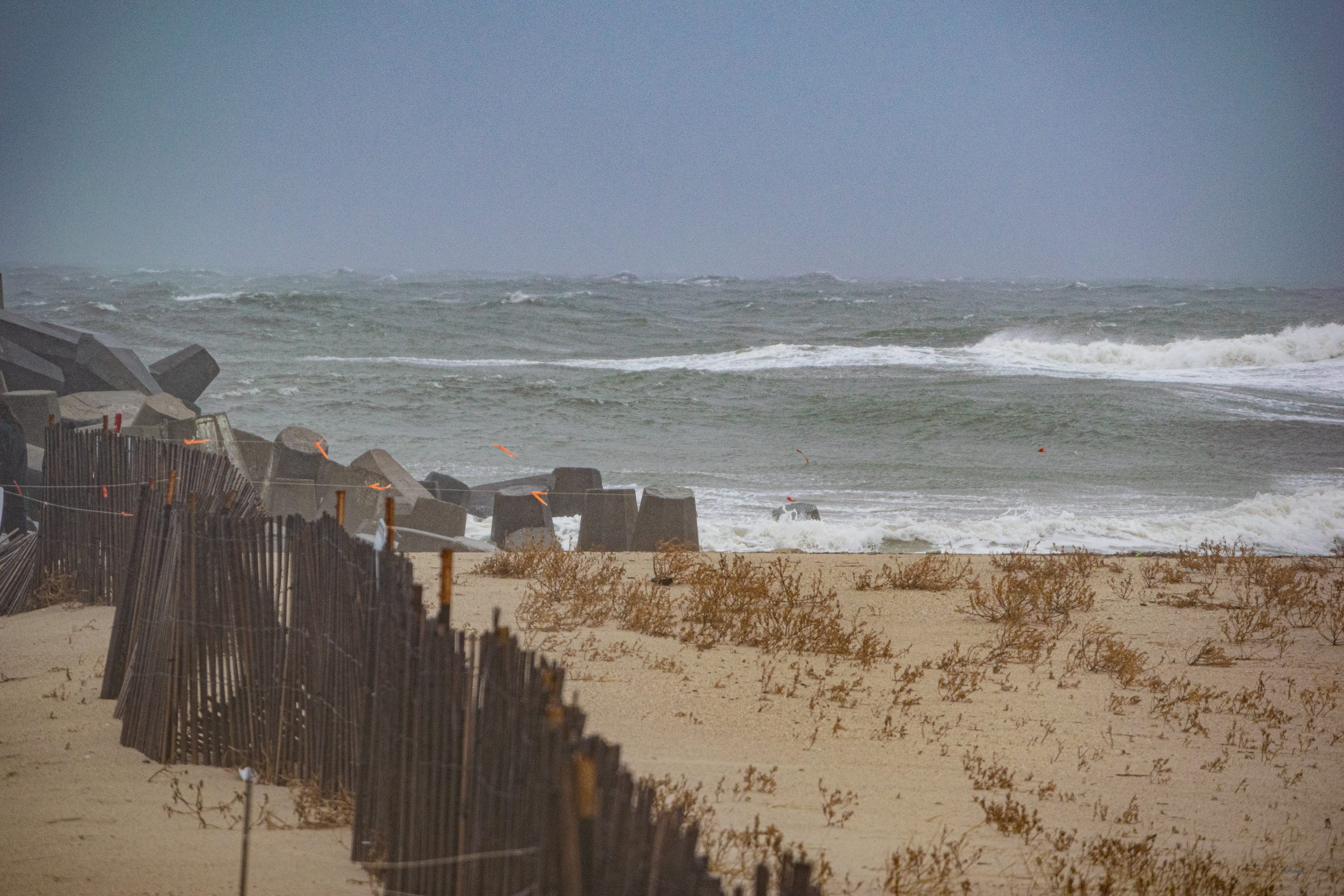
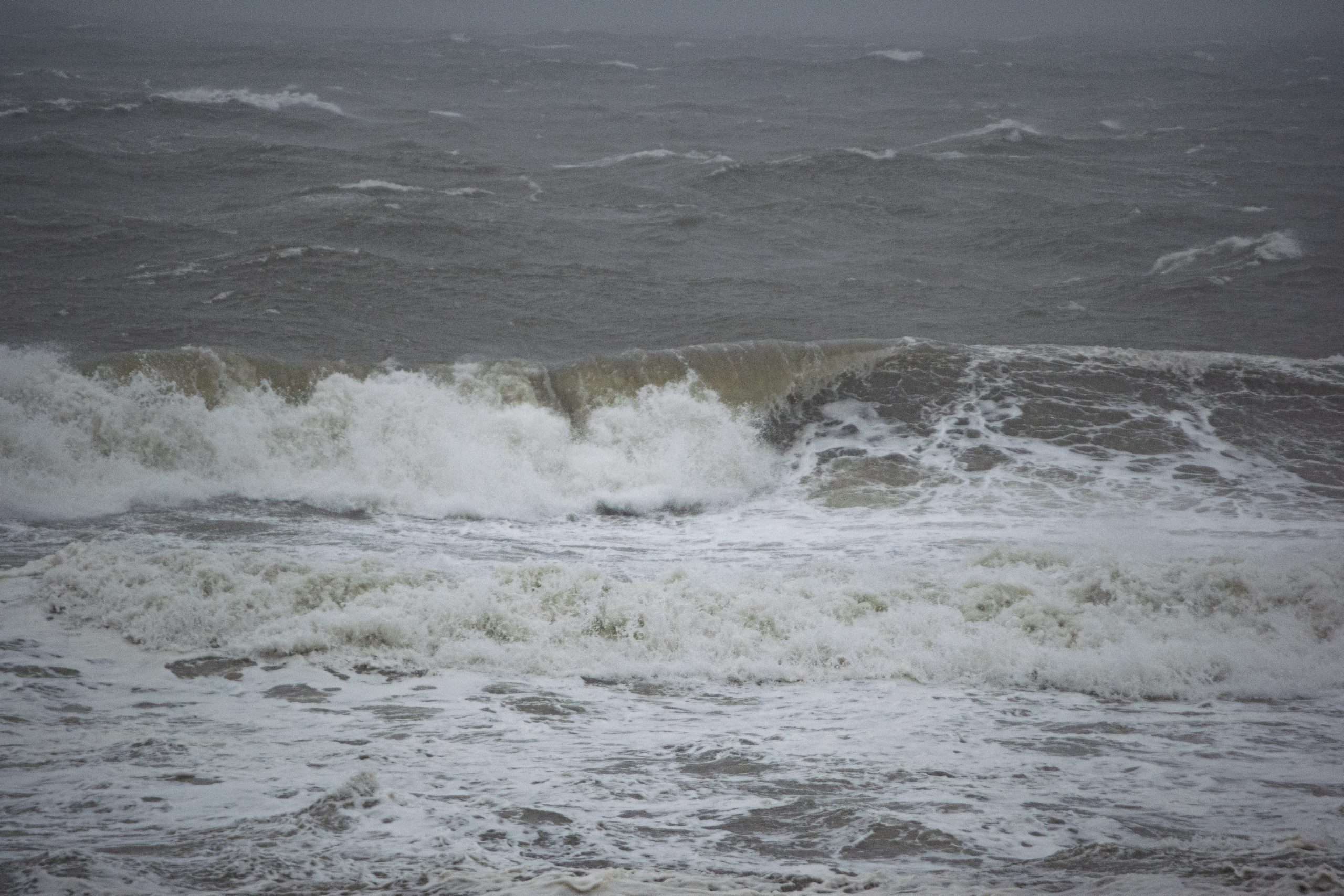
The highest wind speeds and heaviest surf of a continuing multi-day storm powered by the remnants of once-Hurricane Ian were seen Sunday at the Jersey Shore, along with coastal flooding in some bayfront neighborhoods.
The flooding was generally worse to the south of Ocean County, but wind gusts eclipsed 50 m.p.h. and were sustained at about 40 m.p.h. on the oceanfront. The afternoon high tide brought with it wind-blown swells and breakers, attracting a small number of surfers in Point Pleasant Beach and Seaside Heights, while utterly enveloping the inlet jetty at times in a sea of airborne spray and foam.
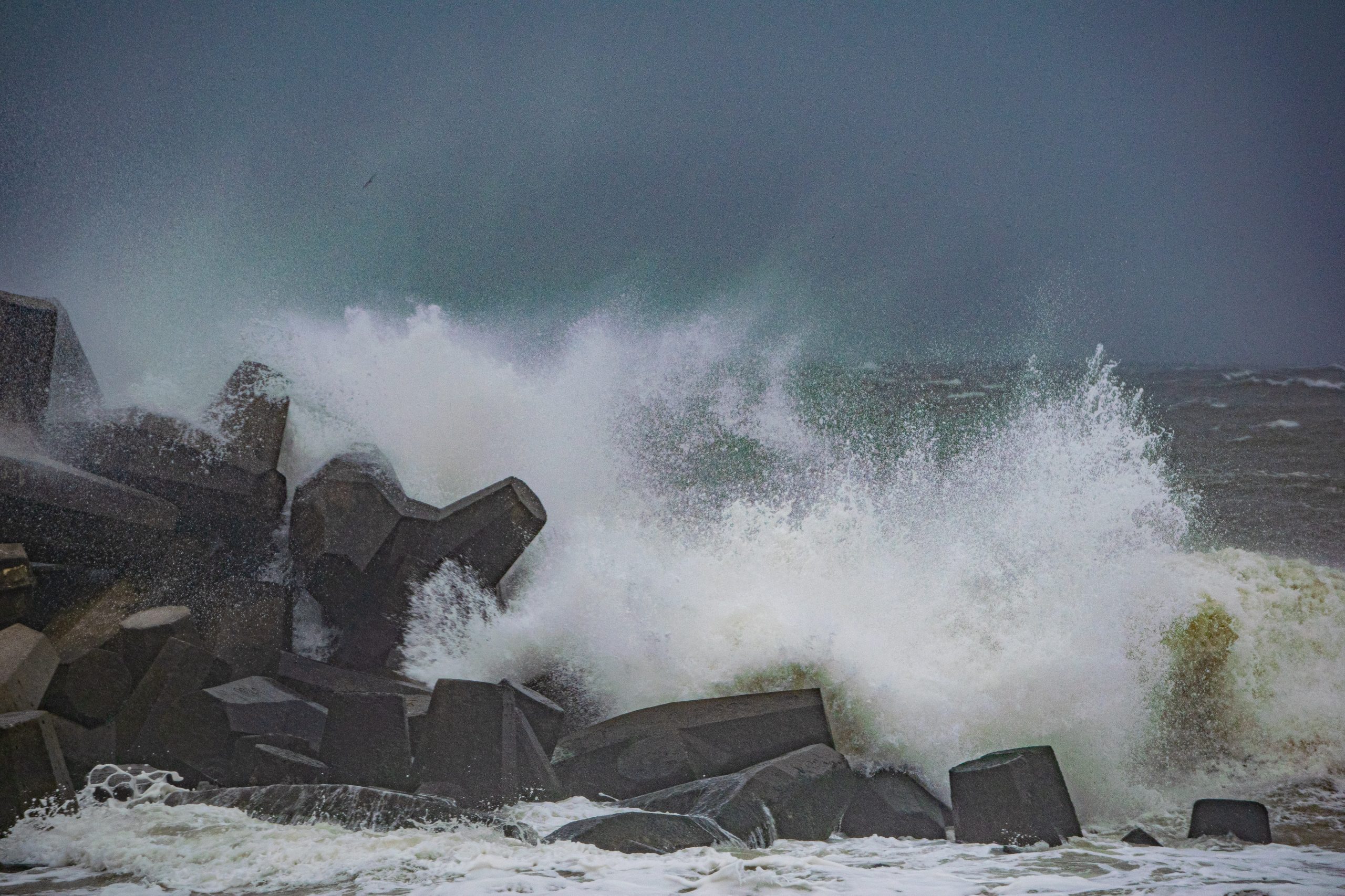
Heavy surf generated by the remnants of Hurricane Ian pound the shoreline in Ocean County, N.J., Oct. 2, 2022. (Photo: Daniel Nee)

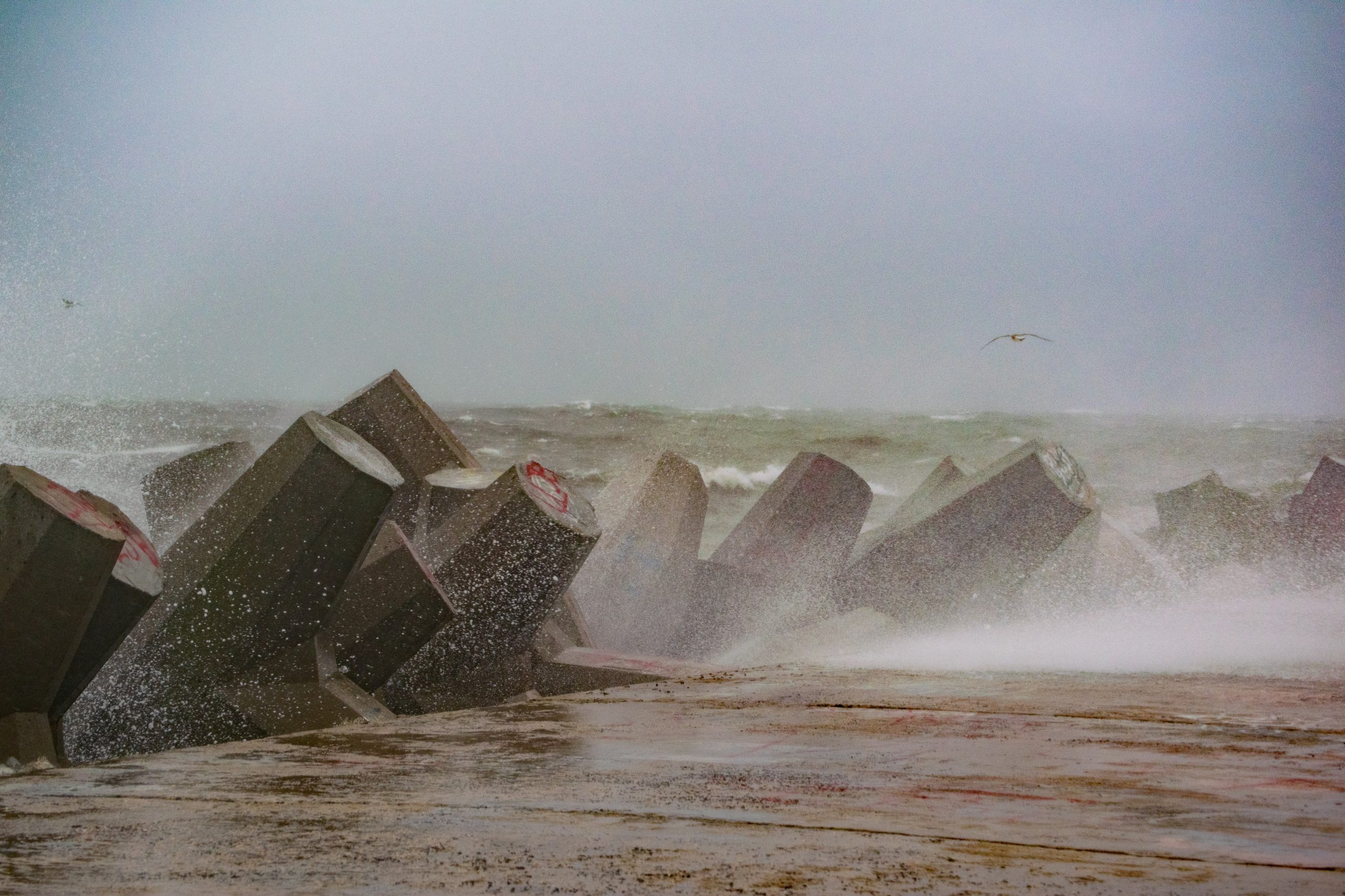
Heavy surf generated by the remnants of Hurricane Ian pound the shoreline in Ocean County, N.J., Oct. 2, 2022. (Photo: Daniel Nee)
Some beaches were showing signs of erosion after the PM high tide cycle, with an escarpment forming in Ortley Beach, Normandy Beach, Bay Head and Point Pleasant Beach. The waves reached beach entrances in some areas, mincing walking paths and sending sand flying in the air. A few tree branches were down.
A High Surf Advisory has been extended to by the National Weather Service through Tuesday, Oct. 4, ending at midnight. A Coastal Flood Warning was likewise extended through 9 p.m. Tuesday.
The NWS forecasts rain will be scattered Monday, though it will pick up after 5 p.m. Winds will be sustained at about 25 m.p.h. with gusts to 40 m.p.h. Showers will continue through Tuesday, and some may extend into Wednesday, however the rainfall amounts will generally be small.

Heavy surf generated by the remnants of Hurricane Ian pound the shoreline in Ocean County, N.J., Oct. 2, 2022. (Photo: Daniel Nee)

Heavy surf generated by the remnants of Hurricane Ian pound the shoreline in Ocean County, N.J., Oct. 2, 2022. (Photo: Daniel Nee)
Heavy surf generated by the remnants of Hurricane Ian pound the shoreline in Ocean County, N.J., Oct. 2, 2022. (Photo: Daniel Nee)
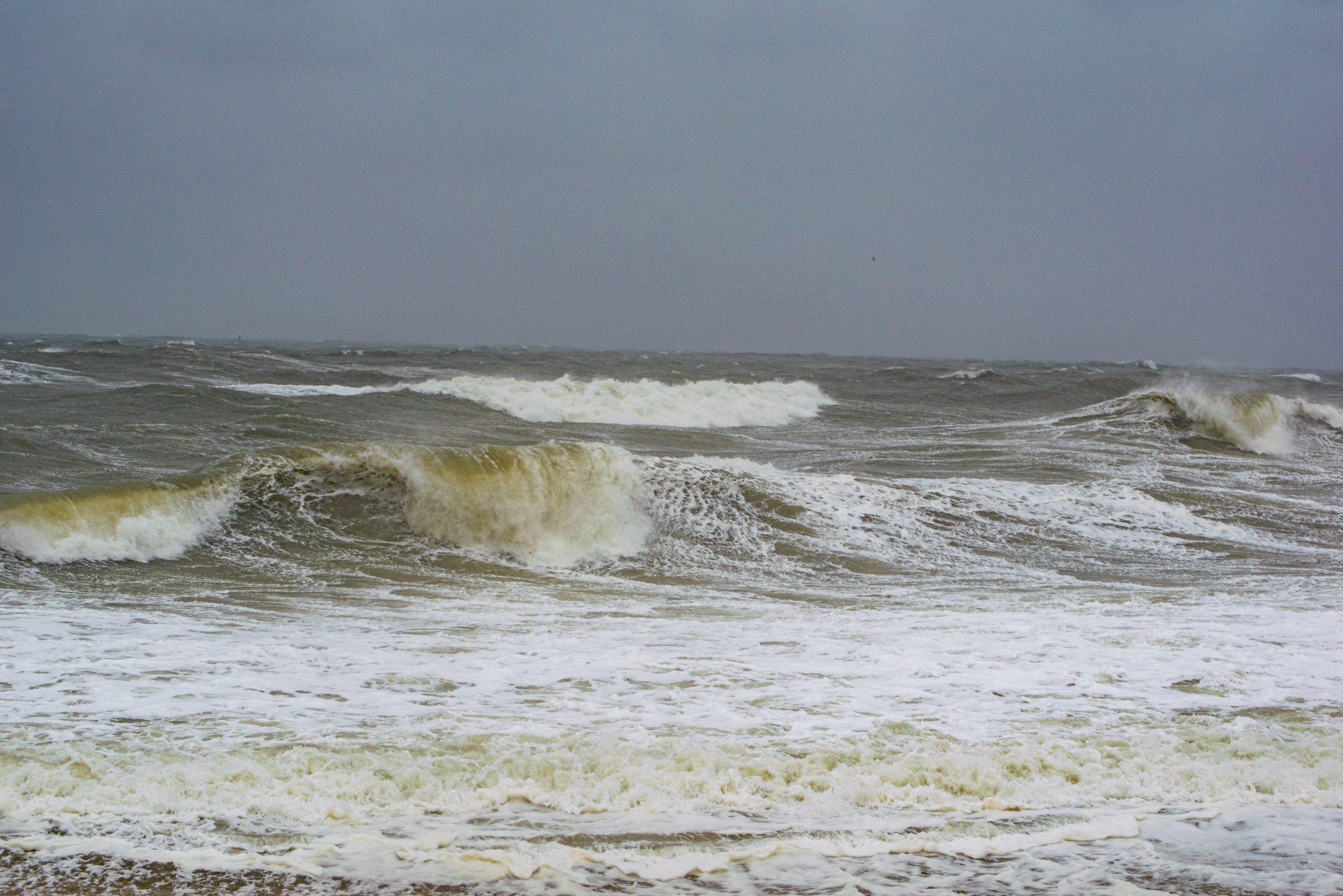
Heavy surf generated by the remnants of Hurricane Ian pound the shoreline in Ocean County, N.J., Oct. 2, 2022. (Photo: Daniel Nee)
It is likely the main impacts of the storm locally will come in the firm of heavy surf and coastal flooding Monday and Tuesday.
“Swimmers should remain out of the water due to dangerous surf conditions,” the NWS advisory said. “Take the necessary actions to protect flood-prone property. If travel is required, do not drive around barricades or through water of unknown depth.”
The NWS is calling for waves as high as 8-feet in the surf zone. Seas will run at XXX. In terms of flooding, 1-2 feet of inundation above ground level in low-lying areas near shorelines and tidal waterways will occur at high tide periods on the bayside.
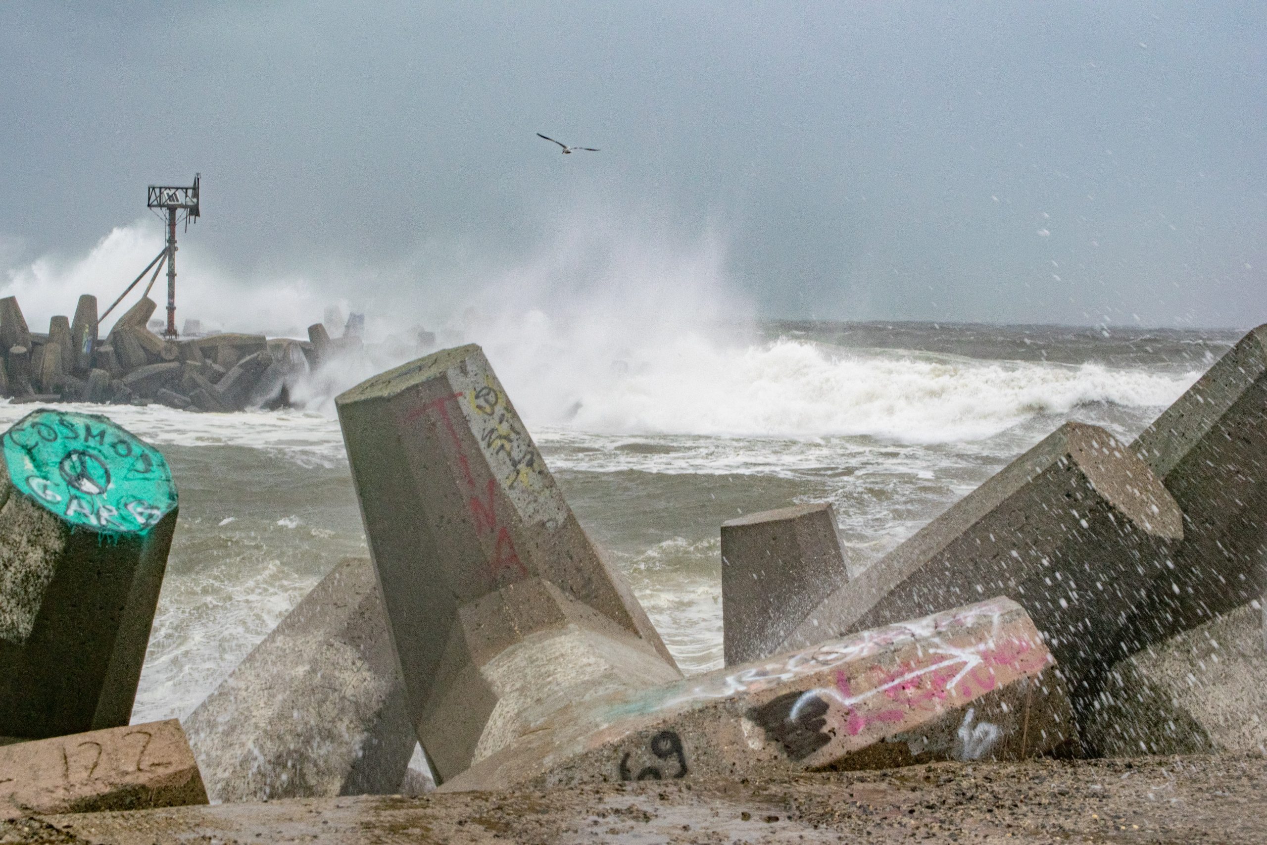
Heavy surf generated by the remnants of Hurricane Ian pound the shoreline in Ocean County, N.J., Oct. 2, 2022. (Photo: Daniel Nee)
Heavy surf generated by the remnants of Hurricane Ian pound the shoreline in Ocean County, N.J., Oct. 2, 2022. (Photo: Daniel Nee)
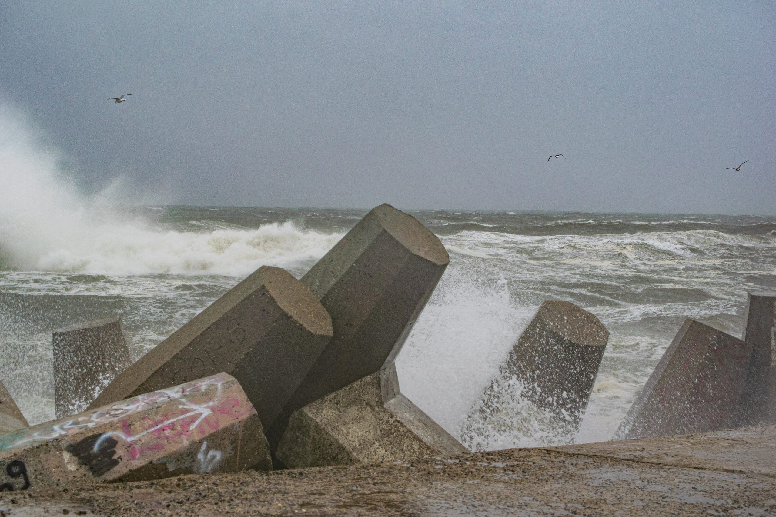
Heavy surf generated by the remnants of Hurricane Ian pound the shoreline in Ocean County, N.J., Oct. 2, 2022. (Photo: Daniel Nee)
“At this level, widespread roadway flooding occurs in coastal and bayside communities and along inland tidal waterways,” the NWS statement said. “Many roads become impassable. Some damage to vulnerable structures may begin to occur.”
Monday High Tide Periods
Mantoloking Bridge (Barnegat Bay): 5:30 a.m., 5:59 p.m.
Seaside Park (Barnegat Bay): 4:42 a.m., 5:11 p.m.
Goose Creek, Toms River (Barnegat Bay): 5:08 a.m., 5:37 p.m.
Inner Metedeconk River, Brick: 3:25 a.m., 3:54 p.m.
Manasquan Inlet, USCG Station: 12:50 a.m., 1:19 p.m.
Seaside Heights (Ocean): 12:32 a.m., 1:01 p.m.


Seaside Heights & Seaside Park
Seaside Heights School Board Seeking More Participation, Will Change Meeting Times

Police, Fire & Courts
Seaside Park Man, 68, Charged in Fatal Crash With Pedestrian

Ortley Beach & North Beaches
Lottery Ticket Worth $10K Sold at Ortley Beach Acme


Ortley Beach & North Beaches
Abandoned Private Island ‘Mansion’ in Barnegat Bay Poised for Demolition

