A deep blue sky began turning cloudy midway through the afternoon Thursday, portending foul weather ahead as the remnants of Hurricane Ian make their way northward, forecast to bring soaking rain and coastal flooding to the Shore area.
As a silver lining, a stunning sunset enveloped the region in a sea of orange and red Thursday night – a final shot of fair weather before several days of storms are expected. (Shorebeat caught some absolutely amazing video, which is embedded above. It’s worth checking out!)
The National Weather Service is forecasting more than 3-inches of rain to fall between Friday and Sunday, with precipitation linger into Monday. There is also a threat of minor tidal flooding during each high tide cycle from Friday afternoon through Sunday afternoon.
There is an increasing risk for minor tidal flooding beginning on Fri. afternoon. Minor tidal flooding is also possible for some of the coast on Sat. afternoon. The tide of greatest concern at this point is Sunday afternoon. #DEWX #NJWX pic.twitter.com/HBnuIhsCg2
— NWS Mount Holly (@NWS_MountHolly) September 29, 2022
Friday will primarily be cloudy, with periods of rain moving into the region at night, the NWS forecast said. The rain will move in mainly after 2 a.m., bringing with it gusty east winds moving 15-20 m.p.h. Between a quarter-inch and half-inch of rain is expected to fall during the overnight hours.
“Heavy rain leading to localized flooding is possible Friday night through Saturday,” the NWS said in a hazardous weather statement.
Saturday will consist of the brunt of the storm, with rain and possibly a thunderstorm moving through, mainly before 5 p.m. A chance of rain and thunderstorms after will continue into the nighttime hours. The high will be near 65. It will continue to be breezy, with a northeast wind around 20 m.p.h., with gusts as high as 35 m.p.h. New rainfall amounts between 1 and 2 inches are possible.
Another inch of rain will fall Saturday night into Sunday, with rain and thunderstorms continuing to roll through during the overnight hours. Winds will continue to be sustained at about 20 m.p.h. with gusts to 30 m.p.h., with a low of 56 degrees.
On Sunday, the high temperature will reach just 63 degrees, with more rain likely. Winds will turn up even higher Sunday, with the NWS predicting 40 m.p.h. gusts from the northeast. The rain will eventually taper, however, with another quarter to half-inch of rain falling during the day.
The wind will continue Sunday night into Monday, gusting to 40 m.p.h., with another half-inch of rain expected to fall. Temperatures will plunge to 53 degrees overnight and are unlikely to reach out of the 50s on Monday, with a chance of rain continuing.
~
Photos From Thursday Night:

Sunset on Barnegat Bay, N.J. as the remnants of Hurricane Ian approach, Sept. 29, 2022. (Photo: Daniel Nee)

Sunset on Barnegat Bay, N.J. as the remnants of Hurricane Ian approach, Sept. 29, 2022. (Photo: Daniel Nee)
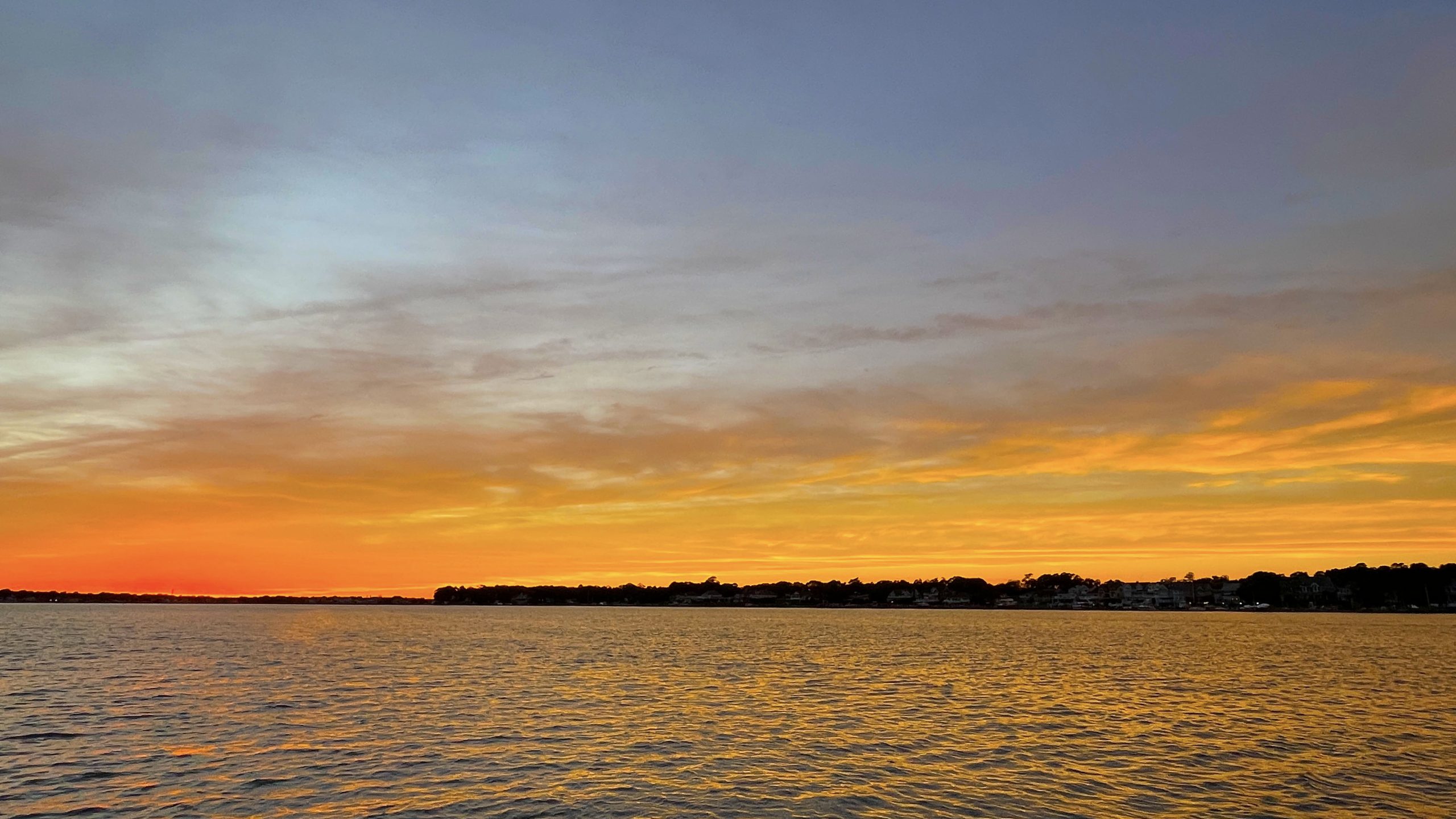
Sunset on Barnegat Bay, N.J. as the remnants of Hurricane Ian approach, Sept. 29, 2022. (Photo: Daniel Nee)

Sunset on Barnegat Bay, N.J. as the remnants of Hurricane Ian approach, Sept. 29, 2022. (Photo: Daniel Nee)

Seaside Heights & Seaside Park
Reminder: Boardwalk Halloween Costume Contest, Free Carousel Rides This Weekend in Seaside Heights

Police, Fire & Courts
Seaside Heights Woman Indicted for Murder, Dismembering Body in ‘House of Horrors’ Case


Seaside Heights & Seaside Park
Seaside Heights Italian Festival, Columbus Day Parade to Return Oct. 11-13


Seaside Heights & Seaside Park
Dramatic Water Rescues Occur in Seaside Park As Rip Current Warning Remains in Effect


Ortley Beach & North Beaches
Abandoned Private Island ‘Mansion’ in Barnegat Bay Poised for Demolition
