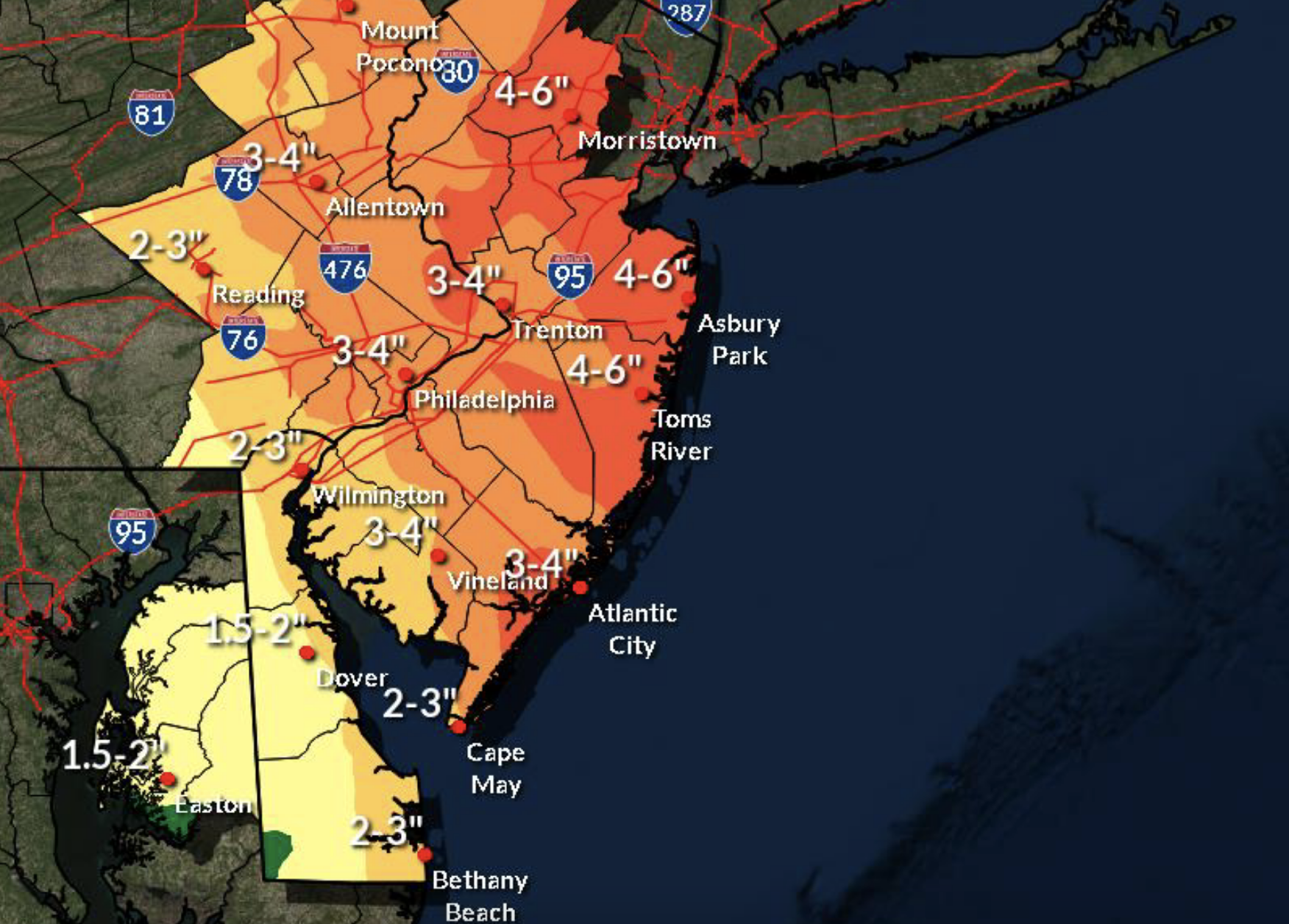
Rainfall totals for the Oct. 26-27, 2021 nor’easter. (Credit: NWS)
The National Weather Service issued a flash flood watch through 6 p.m. Tuesday amidst new forecast models showing that some areas of the Jersey Shore could receive as much as five inches of rainfall over the course of two days during the first nor’easter of fall 2021.
“The potential for heavy rain has increased,” the NWS’s office in Mount Holly said in a briefing statement issued late Monday. “The possibility of gale force winds on the coastal waters is also high. However, there remains more uncertainty about the threat of damaging wind gusts and minor tidal flooding.”
According to the NWS forecast, bands of heavy rain would fall Tuesday morning. Lighter, and intermittent, rain would continue to fall during the day, totaling 1-2 inches of rainfall after an initial inch the previous night.
On Tuesday night, bands of heavy rain are forecast to roll back through the region, bringing another 1-2 inches of rainfall. That period of rain will last until about 5 a.m. Wednesday, the forecast said, and taper off by 8 a.m.
The highest winds in the storm will come Tuesday in the late afternoon hours through Wednesday morning, when gusts will exceed 40 m.p.h., with sustained winds at about 25 m.p.h. A gale warning was in effect for coastal waters off Ocean County. By early Tuesday morning, seas will build to 4 to 7 feet and continue to build to 6 to 10 feet by Tuesday evening, the NWS said. Seas will continue to run up to 10-feet through Thursday – generally, between 5 to 10 feet, before subsiding to still-strong 5-foot swells on Friday.


Seaside Heights & Seaside Park
Seaside Heights School Board Seeking More Participation, Will Change Meeting Times

Police, Fire & Courts
Seaside Park Man, 68, Charged in Fatal Crash With Pedestrian

Ortley Beach & North Beaches
Lottery Ticket Worth $10K Sold at Ortley Beach Acme


Ortley Beach & North Beaches
Abandoned Private Island ‘Mansion’ in Barnegat Bay Poised for Demolition

