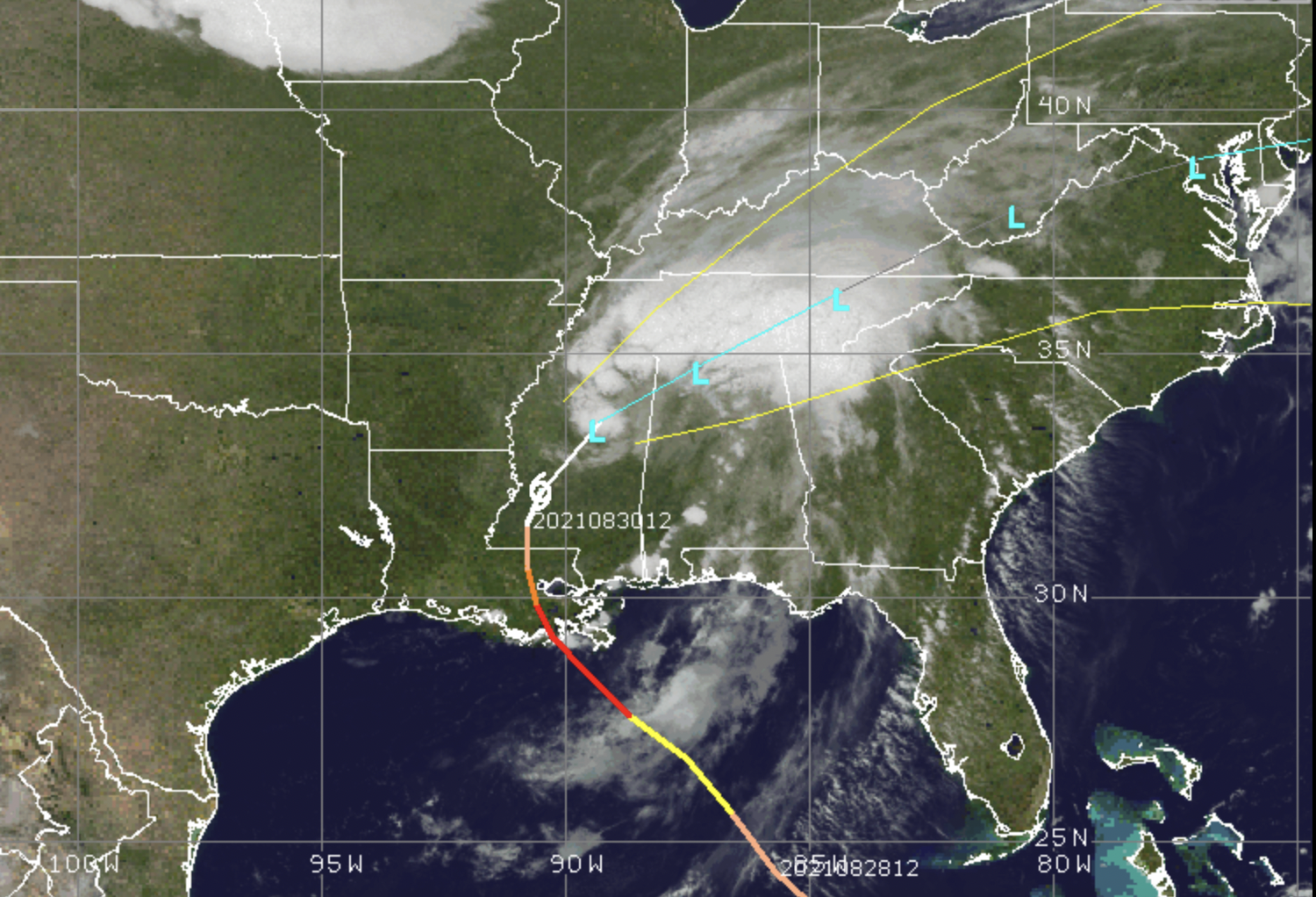
Tropical Depression Ida, Aug. 31, 2021. (Credit: CIMSS/ Tropical)
The Shore area will dodge the bulk of wind and storm surge effects from the remnants of Hurricane Ida – now Tropical Depression Ida – as it chugs northeast toward the region.
The storm system, which is expected to be post-tropical by the time it reaches New Jersey, will bring rain and some gusty winds to the area beginning Wednesday morning. The National Weather Service has issued a Flash Flood Watch from 8 a.m. Wednesday to 2 p.m. Thursday.
According to the NWS forecast, after some chance of a stray shower overnight, more steady showers and a thunderstorm as possible after 7 a.m. Wednesday. Some of the storms could produce heavy rain. North winds will run 5 to 10 m.p.h., becoming east in the afternoon. Heavier bands on rain and thunderstorms will move through Wednesday night into Thursday morning. Winds will remain relatively calm – around 15 m.p.h. – but rainfall totals could be between 1-2 inches.
On Thursday, showers and thunderstorms will linger until about 2 p.m., with gusty winds sustained at 15 to 20 m.p.h. with gusts to 30 m.p.h. Another inch of rain is possible.
The sun will return Friday, with a high of 75 degrees heading into the long weekend.


Seaside Heights & Seaside Park
Annual Turkey Dinner to Support Tri-Boro First Aid Squad: Tickets Available


Seaside Heights & Seaside Park
Seaside Heights Italian Festival, Columbus Day Parade to Return Oct. 11-13

Seaside Heights & Seaside Park
Dramatic Water Rescues Occur in Seaside Park As Rip Current Warning Remains in Effect


Ortley Beach & North Beaches
Abandoned Private Island ‘Mansion’ in Barnegat Bay Poised for Demolition
