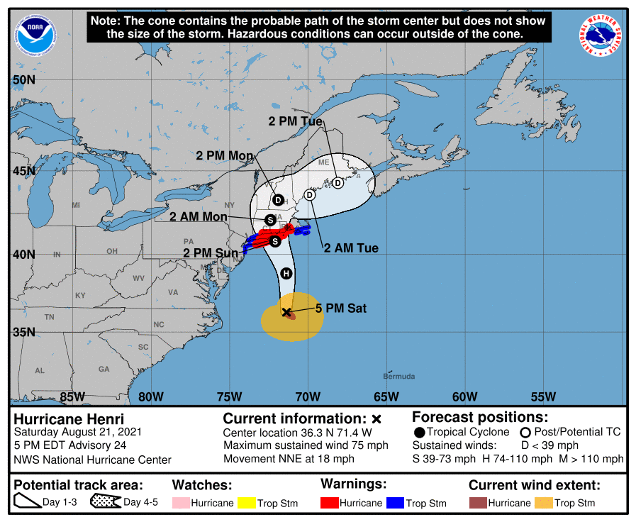
The forecast is continuing to develop as Hurricane Henri moves closer offshore to New Jersey on its way to an expected landfall in Long Island. In an update from the National Hurricane Center and National Weather Service released at 5 p.m. Saturday, forecasters said the storm will bring winds sustained below that of tropical storm strength to Ocean County, but soak the area in rain on-and-off for a period of time.
National Hurricane Center
National Hurricane Center
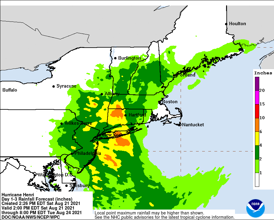
Showers will give way to “possible tropical storm conditions” Saturday night, the NWS forecast said. There is an 80 percent chance of precipitation, with winds forecast to blow out of the southwest at 10-15 m.p.h. with gusts to 35 m.p.h., occasionally reaching the tropical storm threshold of 29 m.p.h. About 1-2 inches of rain will fall overnight Saturday into Sunday.
On Sunday, as the storm is centered off the New Jersey coast, tropical storm conditions are possible. Some of the storms could produce heavy rainfall and additional 2-3 inches of rain may fall, the NWS forecast said. A chance of showers and thunderstorms will linger into Sunday night, however rainfall totals will measure between just a tenth and quarter of an inch, except higher amounts possible in thunderstorms.
At 5 p.m. Saturday, Henri was packing winds of 75 m.p.h., a minimal hurricane. It was located off Virginia and moving steadily northward. It is expected to arc to the northwest and directly strike the south shore of Long Island about 2 p.m. Sunday.
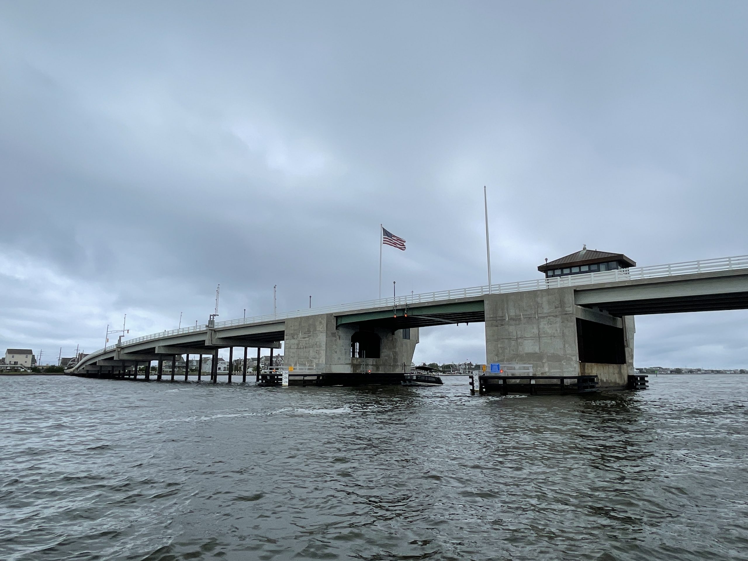
Storm clouds gather at the Mantoloking Bridge, Barnegat Bay, Aug. 21, 2021. (Photo: Daniel Nee)
“The main threat with this system is very heavy rain leading to flash flooding across much of the region,” an advisory from the NWS office in Mount Holly said. “Tropical storm force winds are possible in portions of E Central New Jersey. With a full moon this weekend, minor coastal flooding is also expected, primarily with the high tide this evening along the New Jersey Coast. Minor coastal flooding may linger with the Sunday evening high tide.”
Dangerous marine conditions will develop on the ocean with strong winds, rough seas, and dangerous rip currents, the advisory said. Seas will build to 6-10 feet. A high risk for rip currents is expected to continue through “at least Sunday” for the New Jersey and Delaware coasts.


Seaside Heights & Seaside Park
Seaside Heights School Board Seeking More Participation, Will Change Meeting Times

Police, Fire & Courts
Seaside Park Man, 68, Charged in Fatal Crash With Pedestrian

Ortley Beach & North Beaches
Lottery Ticket Worth $10K Sold at Ortley Beach Acme


Ortley Beach & North Beaches
Abandoned Private Island ‘Mansion’ in Barnegat Bay Poised for Demolition

