Screenshot
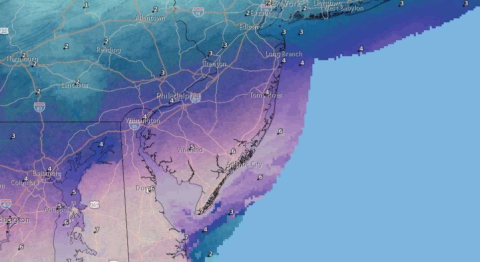
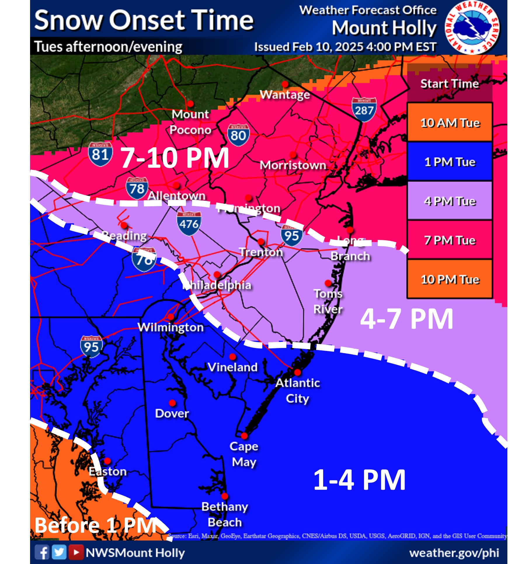
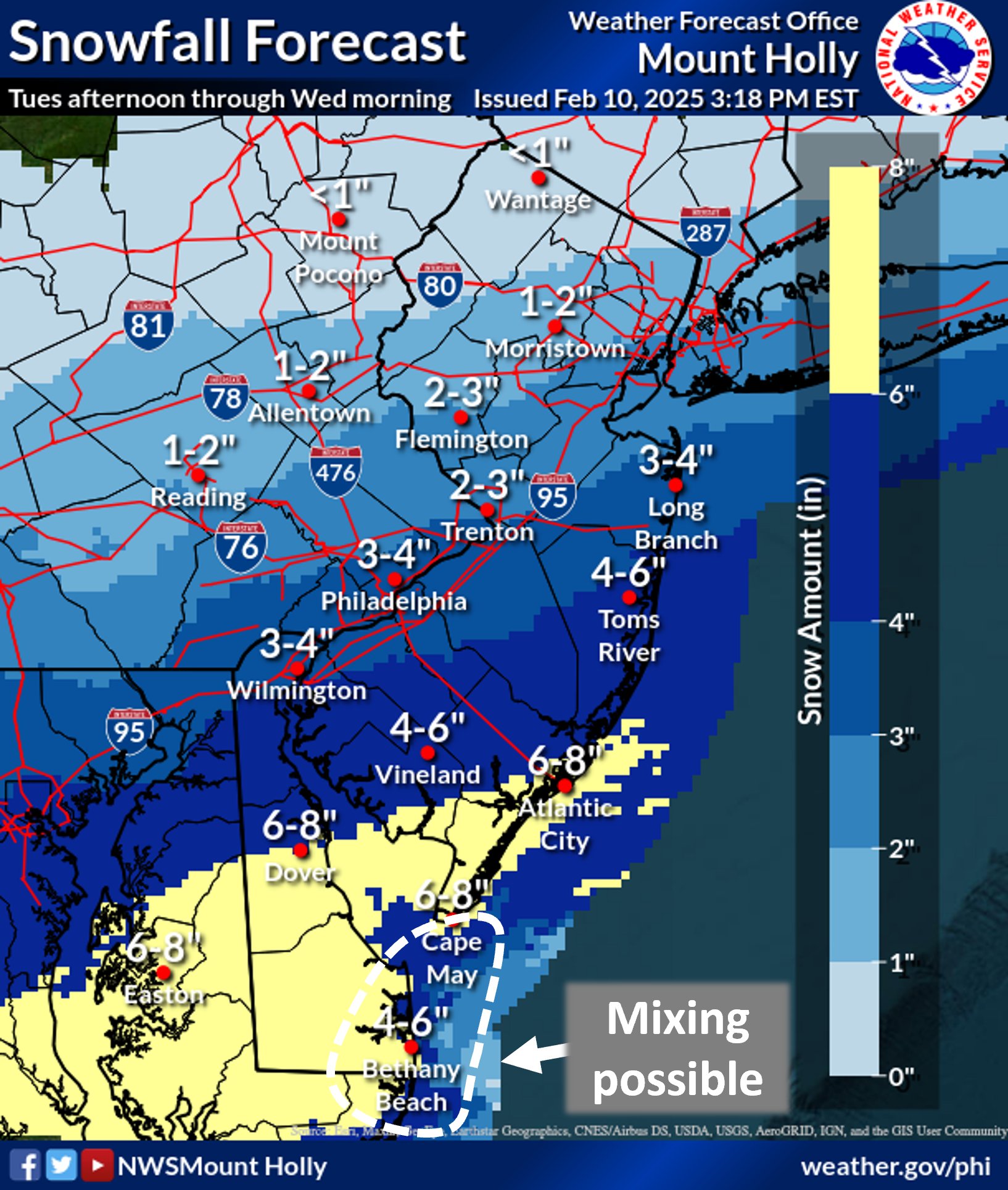
The National Weather Service has issued a winter weather advisory for the Shore area, forecasting 3 to 6 inches of snow. According to the NWS’s latest update, the storm is expected to begin producing snow around 4 p.m. Tuesday.
The winter weather advisory is in effect from 4 p.m. Tuesday to 7 a.m. Wednesday. The NWS forecast calls for less than a half-inch of snow to fall during the day Tuesday, with the rate of snowfall increasing Tuesday night into early Wednesday morning. Overnight, 3 to 5 inches of snow is expected to fall, with another inch by morning. Some areas may see slightly higher totals due to heavier precipitation.
Remaining precipitation is forecast to turn to a wintry mix of rain and snow Wednesday afternoon, from 1 to 4 p.m., with sleet mixing in after 4 p.m. as temperatures drop. Rain, possibly mixed with snow and sleet, will become all rain after 10 p.m. Wednesday. The overnight low will be around 34 degrees. Little or no snow and sleet accumulation is expected on Wednesday.
Rain will continue into Thursday, mainly before 1 p.m. The remainder of the day will be sostly cloudy, with a high near 48.
Sunshine returns Friday, with a forecast high of 38 degrees.


Ortley Beach & North Beaches
Ortley Beach $5M ‘Makeover’ Of Streetscapes, Boardwalk, Parking Ready for Bidding


Seaside Heights & Seaside Park
Seaside Heights Mourns Passing of Boardwalk Legend, Still Working Into His 90s


Police, Fire & Courts
Cops: Juvenile Arrested After 118mph Joy Ride in Seaside Heights, Toms River Kills 2


Police, Fire & Courts
Ocean County Sheriff Establishes Drone Command Center in Seaside Heights Amid New Video


