
Flooding in Seaside Park, Nov. 26, 2018. (Photo: Daniel Nee)
Seaside Park officials have agreed to move ahead with a project to combat road flooding in the face of continued legal wrangling with the federal government on a wider plan to enlarge the sand berm along the bayfront and build a “living shoreline” that would serve as a reef to block wave action.
The major plan has received an endorsement from the borough, numerous research scientists as well as the state Department of Environmental Protection, however it has been opposed by the U.S. Army Corps of Engineers due to concerns that it would prevent sea grass from growing in certain areas, despite the fact that no sea grass has been found to be growing directly along the bayfront.
The new plan would not replace the concept of the enlarged berm and living shoreline, but would be a project that would require less in the way of red tape and fewer approvals from agencies in different levels of government. It could be completed, officials say, while the borough continues its battle with the Army Corps over the larger project.
“There was a lengthy exchange of ideas between the Bayfront Committee and the governing body” at a recent meeting, said Mayor John Peterson. “They brought a good deal of expertise, and the issue that’s being addressed is multi-faceted, but one of the proposals that had a great deal of support in terms of consensus … entails sheathing and a five-foot elevation.”
Sheathing is the technical term for what most residents know as a bulkhead. The project would combine a new bulkhead with a number of storm sewer improvements, plus seek to tie-in the borough’s stormwater management system with diesel-powered pumps installed by the state during the Route 35 reconstruction project. Historically, since the Route 35 project was completed, the state had not allowed tie-ins from local communities to the pump systems, however Mantoloking was recently allowed to do so, opening the possibility for other municipalities to do the same.
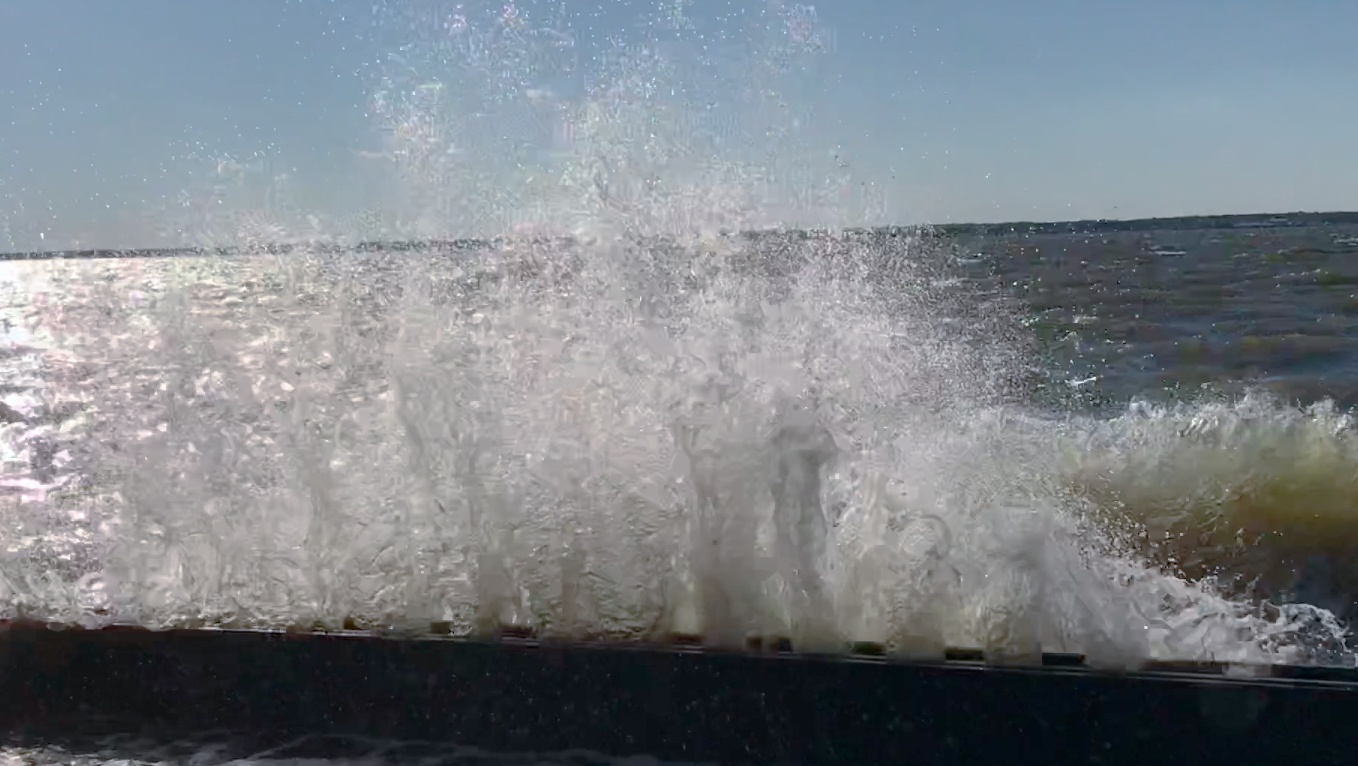
A wave crashes over a bulkhead in Seaside Park, N.J., Oct. 30, 2017. (Photo: Daniel Nee)
The new plan, which could be expedited, would not fall under the Army Corps’ jurisdiction, and is not likely to require approval under the state’s notoriously-lengthy CAFRA (Coastal Areas Facilities Review Act) permitting process.
“This dovetails into our ongoing request with the DOT to allow tie-ins to the pumpout stations, and that is a component here,” said Peterson, referring to the state Department of Transportation, which installed the pumps up and down the barrier island. “The other aspect that is proposed will entail utilization or moving some of the storm drains, retiring a few of the storm drains, but it depends on what permission the DOT may give us.”
Councilman Marty Wilk said the project would include new bulkheading that would protect against an “elevation five event,” the technical term for a flood that would affect land five feet above the base flood elevation. The project would encompass the area between the J Street Marina and 14th Avenue, and would seek to level off the drainage systems along the stretch of land so water could be more effectively prevented from backwashing onto streets – and new water could be pumped out.
“We have to look at the marina, the dock, the avenues – everything has to be tied in to the same height,” said Wilk.
Wilk said the project still has to be designed by one of the borough’s engineering firms, RVE, and the height of the new bulkhead that would be constructed has not yet been determined. Councilman Jerry Rotonda suggested RVE create renderings of the proposal before the council votes to approve it so residents can see what the bayfront will look like.
Responding to a question from a resident, Wilk said that existing vegetation will not be removed along the bayfront, and the bulkhead will run from the marina to 14th avenue.
Peterson explained that the raising would be minimal in comparison to what is in place from 14th street to 12th street, where Ocean County has pursued its own flood mitigation efforts.
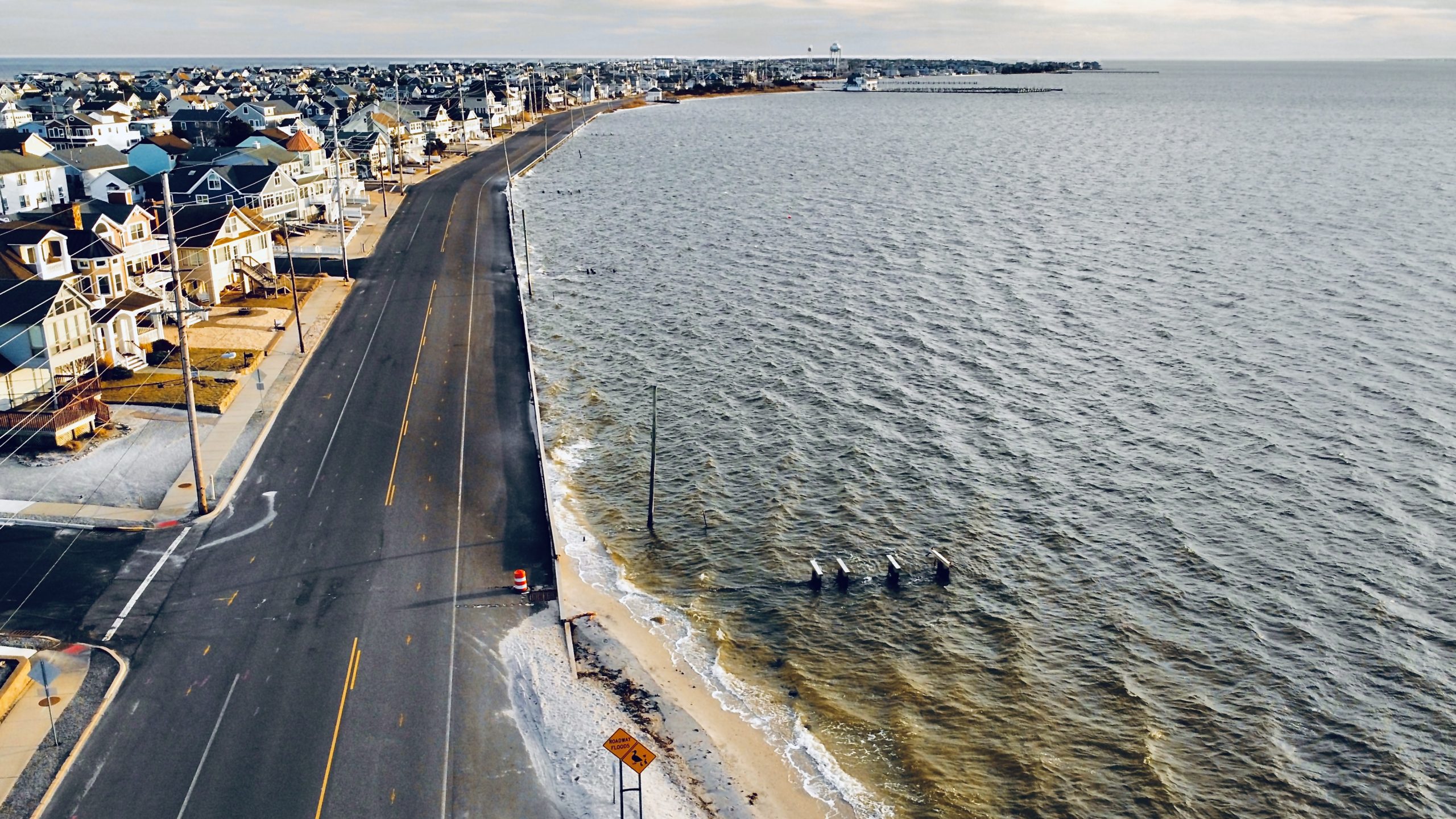
The Seaside Park bayfront along Bayview Avenue, Feb. 2023. (Photo: Daniel Nee)
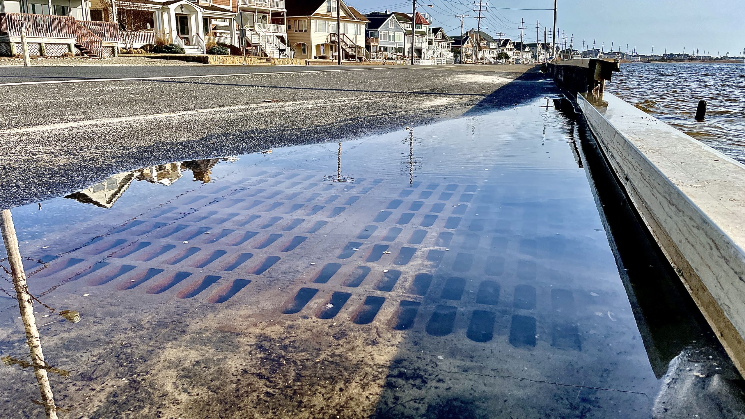
Flooding during a typical high tide on a fair-weather day in Seaside Park along Bayview Avenue, Feb. 2024. (Photo: Shorebeat)
Officials reiterated that fact that the borough is not abandoning its ultimate goal of gaining approval for the larger shoreline project. The newly-proposed project would effectively tie-in with that effort should it come to fruition, but also provide an expedited flood mitigation to provide some relief to beleaguered residents on the bayside.
According to Peterson, an engineer who serves on the bayfront committee determined the “worst four events which occurred since Sandy have all occurred this past winter season.”
The consensus is that the new project would require approval from Ocean County and the DOT.
“That is one of the benefits,” said Peterson. “We’re hopeful that this project will only entail permission from Ocean County, and to a certain extent, the DOT, but that’s for the tie-in to the pump stations.”
“Let’s hope this project can be fast-tracked,” the mayor added.
Shorebeat, later this week, plans to publish a follow-up article on the pending living shoreline project, with a response from the Army Corps on why it has declined to approve it thus far – and what the federal agency is willing to approve.

Police, Fire & Courts
Police Investigating Possible Shots Fired in Seaside Heights


Police, Fire & Courts
Cops: Juvenile Arrested After 118mph Joy Ride in Seaside Heights, Toms River Kills 2


Seaside Heights & Seaside Park
Seaside Heights Mourns Passing of Boardwalk Legend, Still Working Into His 90s


