Skies began changing Wednesday afternoon as the first signs of an incoming storm system made their appearance. The view over Barnegat Bay and at the Seaside Heights boardwalk and pier can be seen in the short video above.
But the colorful afternoon mix of clouds and sun will give way to a gloomy Thursday, despite a forecast high of 64 degrees. There are no watches or warnings in effect, though there is a chance for strong thunderstorms Thursday night into Friday.
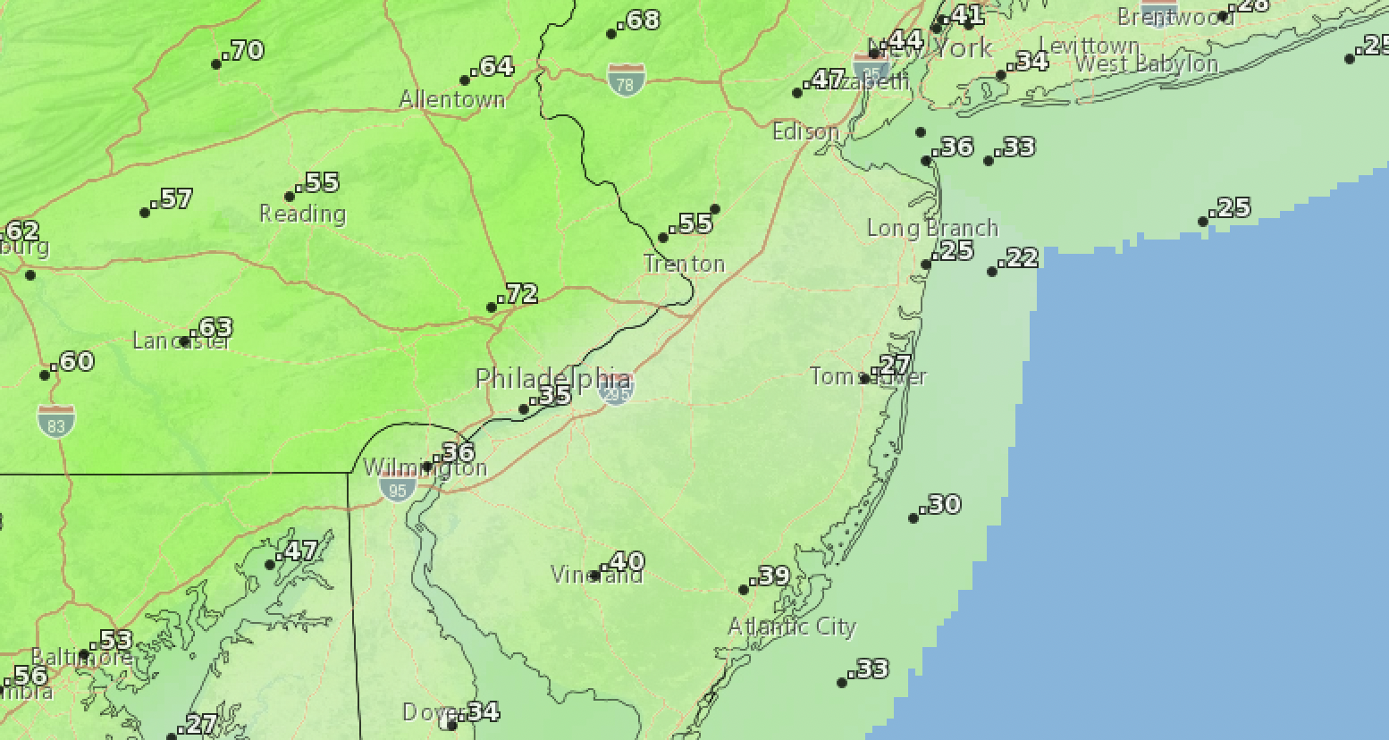
Expected rainfall totals through Friday. (Credit: NWS)
The National Weather Service is forecasting the following pattern:
There will be a chance of showers after 3 p.m. Thursday, but it will otherwise be cloudy, the NWS forecast said. It will be breezy, with a south wind 15 to 20 m.p.h., with gusts as high as 40 m.p.h. The chance of daytime precipitation is 30 percent.
Thunderstorms will move in Thursday night, mainly before 3 a.m. Friday morning, then a chance of showers. The overnight low will be around 50 degrees. It will continue to be breezy, with a south wind 15 to 20 m.p.h. decreasing to 10 to 15 m.p.h. after midnight. Winds could gust as high as 35 m.p.h. About a quarter-inch of rain will fall overnight, though totals may be higher in areas where there are strong thunderstorms.
The good news is that the storm will move out in time for the weekend. Friday’s forecast is for partly sunny skies, with a high near 62 degrees. West wind 5 to 15 m.p.h, with gusts as high as 30 m.p.h., the NWS said.
The sun will continue into Saturday, though highs will not reach past the 50s.


Ortley Beach & North Beaches
Landmark Ortley Beach Breakfast Spot Looks to Expand

Ortley Beach & North Beaches
‘Temporary’ 70-Foot Cell Tower on Route 35 in Ocean Beach OK’d to Return

Seaside Heights & Seaside Park
Beloved South Seaside Park Restaurant Will Remain Open As Developer Seeks to Demolish Block


Seaside Heights & Seaside Park
In Seaside Heights, A $50M Flagship Building Rises Over the Boulevard in a Famed Location

Police, Fire & Courts
Ocean County Sheriff Establishes Drone Command Center in Seaside Heights Amid New Video


