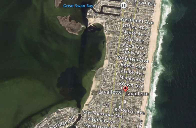
When the state Department of Transportation dredges the Lavallette Channel in Barnegat Bay, which runs from Ortley Beach to Ocean Beach, dredge material will be used to fill two holes in the floor of Barnegat Bay, raising concerns over the potential for shoaling to increase near the West Point Island Bridge.
The holes were dug out after the 1962 nor’easter when the state used bay sand to replenish the borough’s badly-damaged beaches, Mayor Walter LaCicero said.
“Now, they intend to fill them,” said LaCicero. “I’m not sure that this is the best place for the dredge material.”
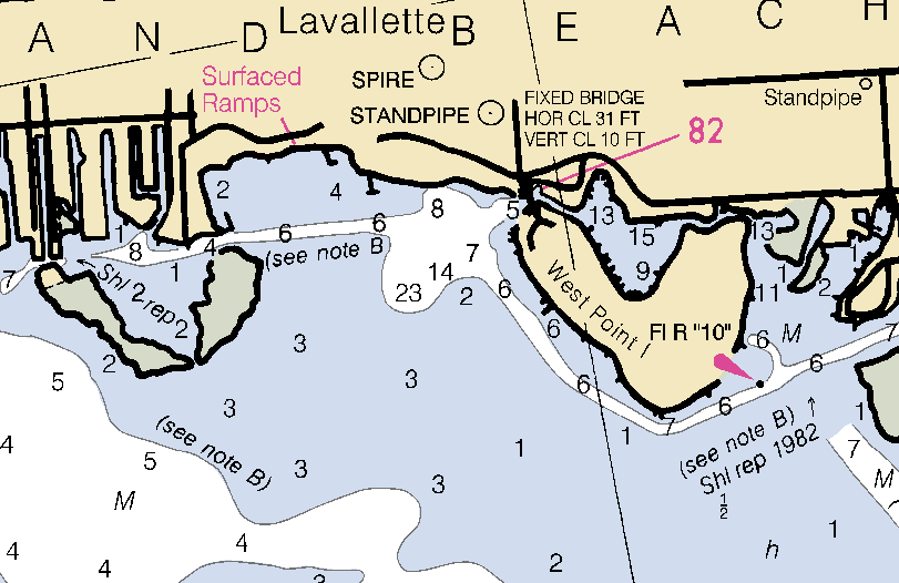
The holes can be seen in aerial photography and from small planes. They are located off the northeast corner of West Point Island, off the borough’s bay beach. According to a nautical chart, the holes are surrounded by water with depths of between 1 and 3 feet which drop quickly to 23 feet. The news that the holes will be filled came in a new state report on the project released to borough officials in recent weeks.
“Their plans for the dredge spoils differ greatly from what we discussed earlier,” said Councilman James G. Borowski. “I know there’s deep water there because it’s one of the few places you can do some water skiing, but it might exacerbate issues at West Point Island.”
Temporarily relieved by Superstorm Sandy’s strong storm surge, frequent shoaling issues at the West Point Island Bridge have returned. Earlier this month, borough officials cautioned boaters about the shallow depths and implored youngsters from throwing rocks into the water since they pose a hazard to passing boats.
LaCicero said the borough should consider contacting Dr. Stewart Farrell, director of the Coastal Research Center at Stockton University, who has previously consulted with the borough on marine-related projects.
“It is early, but we certainly could use some guns in our arsenal,” the mayor said.

Advertisement

Seaside Heights & Seaside Park
PBS ‘Shore Week’ Series to Chronicle Seaside Heights Broadway Performances

Police, Fire & Courts
Vehicle Careens Off Route 37 Causeway, Driver Gets Multiple Summonses

Police, Fire & Courts
Seaside Park Police Blotter: Directions Home, Keeping an Eye Out

Police, Fire & Courts
Cops: Juvenile Arrested After 118mph Joy Ride in Seaside Heights, Toms River Kills 2

Seaside Heights & Seaside Park
Seaside Heights Mourns Passing of Boardwalk Legend, Still Working Into His 90s


